Just a few miles north of the bay of the mighty Penobscot River, he city of Bangor sits. Though Bangor would be considered tiny by most city standards around the country, it is one of Maine’s largest, and a center of commerce and culture for the state. It connects the rural Highlands, Downeast, and Aroostook regions of the state with the rest of civilization to the south. But, its perhaps most notable trait, for our purposes today, is that it houses the literal turning point of US Route 2, where it changes from its long wind south to look west towards the White Mountains.
This is the second part of my two-part series on Route 2. Make sure to read part one before moving to this part. It’ll still be here!
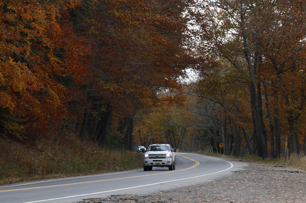
Etna
West of Bangor, Route 2 meanders its way along the northern side of Interstate 95 through several small towns of the southern Highlands, including Hermon, Carmel, and Damascus. But my next stop was one town later, in a small pull off across from the Etna town office.
Each of these small communities acts as a junction between Route 2 and the smaller routes of the region. Here in Etna, it crosses over ME 143, connecting the towns of Stetson and Dixmont across both sides of the interstate. This junction, being so small, carries with it not much else outside of this town office, its volunteer fire department, and the few houses poking through the forest.


Newport
The next major town I found myself in was Newport. Though similar in size to the previously-crossed Lincoln in the northwest, even featuring a parallel body of water in Sebasticook Lake, Newport leans far more in a residential direction. What it may lack in businesses, it makes up for in the quaint communities built along its central river.
I stopped to take a small trail through Newport’s Riverwalk Park, a community center and small scenic hike along a small portion of the Sebasticook River. I chatted with some friendly locals who were interested in my photo gear, climbed a rock staircase to the bridge overlooking part of the lake, and took some time to sit in the empty gazebo-sized stage and relax by the flow of the stream to my east.
The western half of Newport holds its commercial sector, with a small set of chain restaurants, hardware shops, and truck stops, marking the last direct connection Route 2 has with I-95 before it winds south towards Augusta and the Kennebec Valley. Now, we travel on, into the disconnected farms, mill towns, and mountains of Maine’s western reaches.


Canaan
Continuing west, in the small town of Canaan, I found one last boat launch to stop and take a look at on this journey, here at the Lake George Regional Park.
This small lake is found nestled between several of the area’s hills, with an isle of foliage cutting across it in the southern bay. I stopped and walked down to the ramp, finding a local fisherman who was happy to be part of a few shots.


Skowhegan
The next town in, and by far the largest town on this leg of the trip, is Skowhegan. Given it was early November, peak foliage season was just about over, but not quite just yet.
Though many leaves had already fallen, the trees along the town’s eastern section along the Kennebec River were still bright and vibrant, encompassing the road in a deep orange and red hue.
This (and neighboring Norridgewock) marks the crossing of Route 2 through the Kennebec Valley, passing over the several forks of the river through the Skowhegan area. This makes for one of the most scenic spots to view the Kennebec, and I made great use of that fact in exploring the Kennebec Banks Rest Area. Climbing down the rocks to the river’s shore, I admired the communities built along it, respecting its innate natural beauty.


Wilton
It was a little while before I could find another place to stop. Past Skowhegan, Route 2 travels through a couple other large towns in Norridgewock and Farmington. But when I did eventually find a place to park, it was well worth it.
Lakeside Cemetery sits just north of Route 2 in Wilton, and is, perhaps expectedly, positioned along the southern shore of Wilson Lake. Across the water, I got my first glimpse of the western mountains of Maine, a small opening to the parts of the White Mountains that jut into the state.
Walking through the cemetery, I found myself drawn down the hill to the lakeside, and a small pull-off on the parallel Lake Road. This time of year, the summer homes of the lake are shuttered, and the water is calmer than usual, ready for the upcoming freeze of the winter months.


Rumford & Mexico
Continuing west, Route 2 hits one last major town before the New Hampshire border, and that comes in the form of a pair. Rumford and Mexico operate on opposite sides of the Swift River, which meets up with the Androscoggin here before it continues south towards Lewiston-Auburn.
The neighboring towns are the site of one of Maine’s last operational mills, and the influence of the industry is very clearly present (albeit, with a harsh smell that’s just as much so). But with that industry also comes a community tied to its past, and the small houses and businesses along this stretch show it beneath the backdrop of mountains to their northwest.


Bethel
Though Rumford and Mexico are significantly larger, one final notable town on the road to New Hampshire is that of Bethel.
Most well-known as a ski town in the winter serving nearby Sunday River, Bethel is surprisingly humble in all other seasons. In foliage season, the entrance to Maine’s small slice of the White Mountains is bookended by color from all sides. I stopped here to take one last look east, before setting off once more on the final leg of my journey.

Gilead
Gilead marks the end of Maine’s coverage of Route 2, and the entrance to New Hampshire. Winding along the Androscoggin and between the ridges of the White Mountains, the town’s rural nature feels untouched beyond the road and the railway running by its side.
I stopped one more time in Gilead, this time taking a short detour north on Bridge Street. With the sun setting, I stepped up to the town’s Green Bridge and looked across the Androscoggin. I sat there for a while, admiring the light peering across the mountains to the north and bathing a lone fly-fisherman in contrasting color, and listening to the silence interrupted by nothing but the wind and late-singing birds. Sometimes, even on One Roads, it’s best to head off the beaten path just a little to find the most serene views.
Someday I’ll likely revisit Route 2 and travel its run through the rest of New England, but for now, this is where my journey ends. Route 2 is a long but incredibly varied road, with a healthy mix of major points of interest and forgotten rural gems, and is well worth the trip in any season. But something about the last days of foliage season, after the tourists have left but before the color is fully gone, makes this road especially a joy to traverse.


Leave a comment