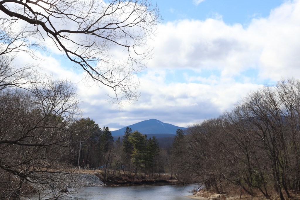
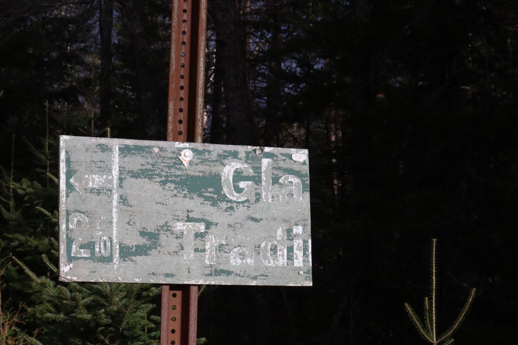
In the far western reaches of Maine’s Lakes and Mountains region sits the Magalloway River, entering the state from the rural north of New Hampshire. With no major towns around for over 20 miles in any direction, Maine Route 16 starts here, connecting New Hampshire Route 16 to the east.
Maine Route 16 moves from here in Magalloway all the way through to Orono, on the Penobscot River. Along this road, it passes through some of the most remote scenic places in the state, including the Rangely Lakes, Carrabasset Valley, and the northern Highlands.
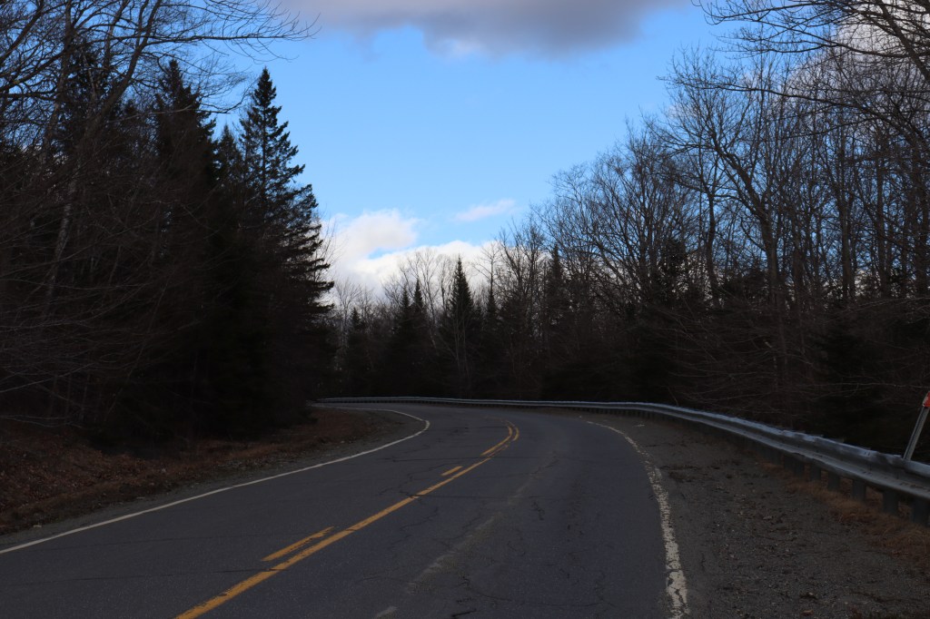
I started this drive directly following my journey across New Hampshire Route 16, and followed the last of the sunlight until Eustis before leaving and returning a couple days later to drive the rest. This road has a lot of verticality and riverside vistas, so I wanted to make sure to capture it on a clear day.
This is my journey down Maine Route 16.
Rangely Lakes Region
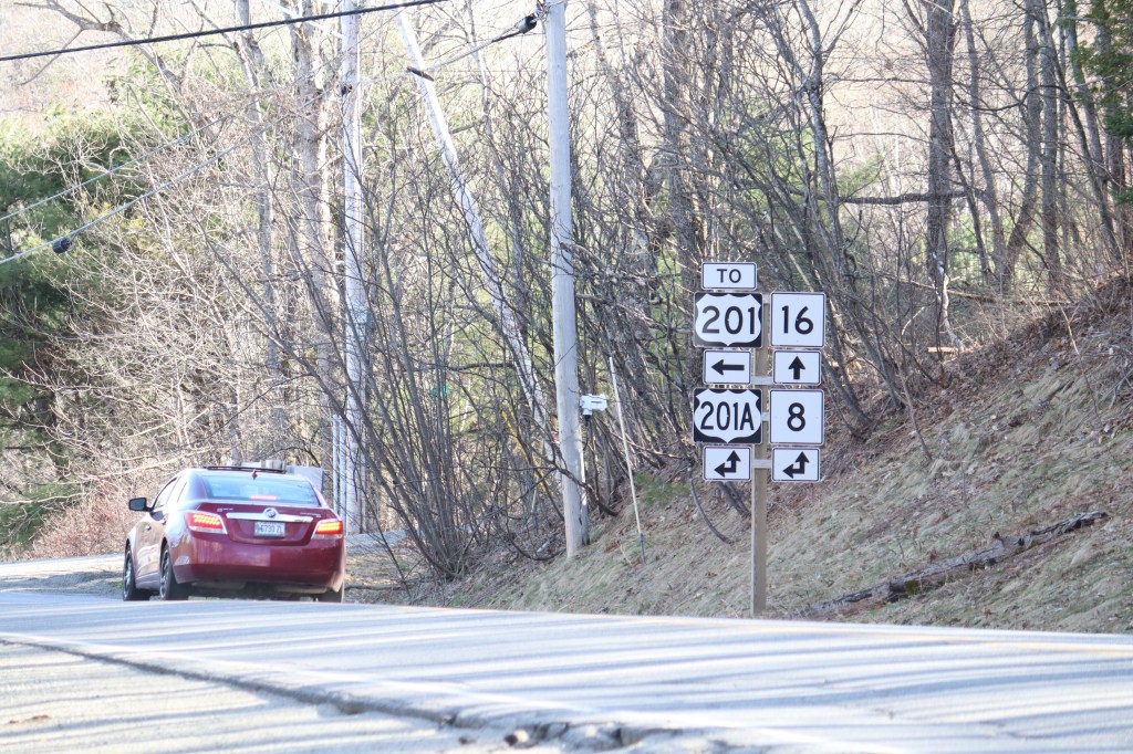
Though Maine Route 16 is an east-west road, it starts going due north where New Hampshire Route 16 left off. In the township of Lincoln Plantation, it turns and meanders its way east to the first signs of life on this rural roadway.
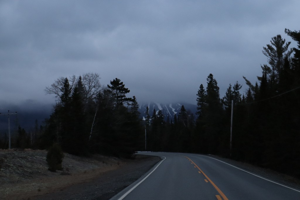
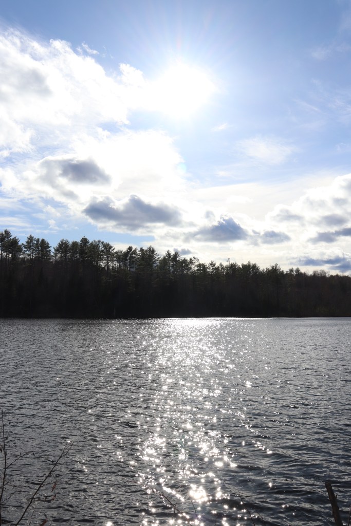
Through the mountains, the first intersection Route 16 meets is that of Route 17 in the villages of Oquossoc and Mountainview on the northwest corner of Rangely Lake. This area is niche for explorers to begin with, but during the muddy offseason, the trails and cabins are empty, mind for a few hardy locals.
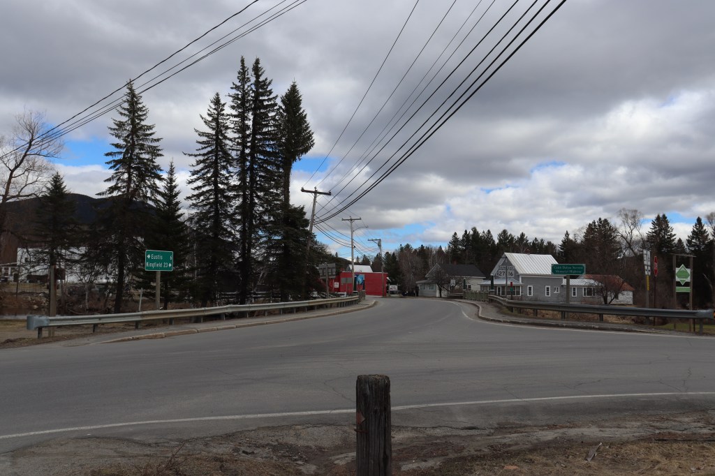
Soon, I come up on the first town on Maine Route 16, that being Rangely proper. Unfortunately, as the sun sets over the faraway mountains in the southwest, it’s not plausible for me to get as many pictures. Nevertheless, I continue to Eustis in the north, and mark my ending spot to return to another day.


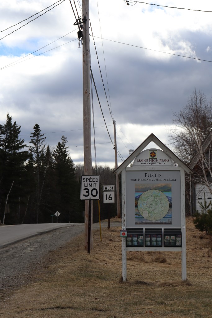
Eustis
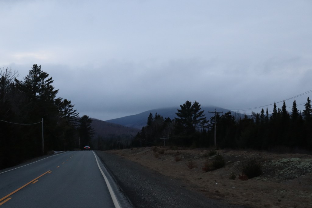
That other day came pretty quick, as just two days later, I found myself back in the village of Stratton in the south of Eustis to continue my journey.
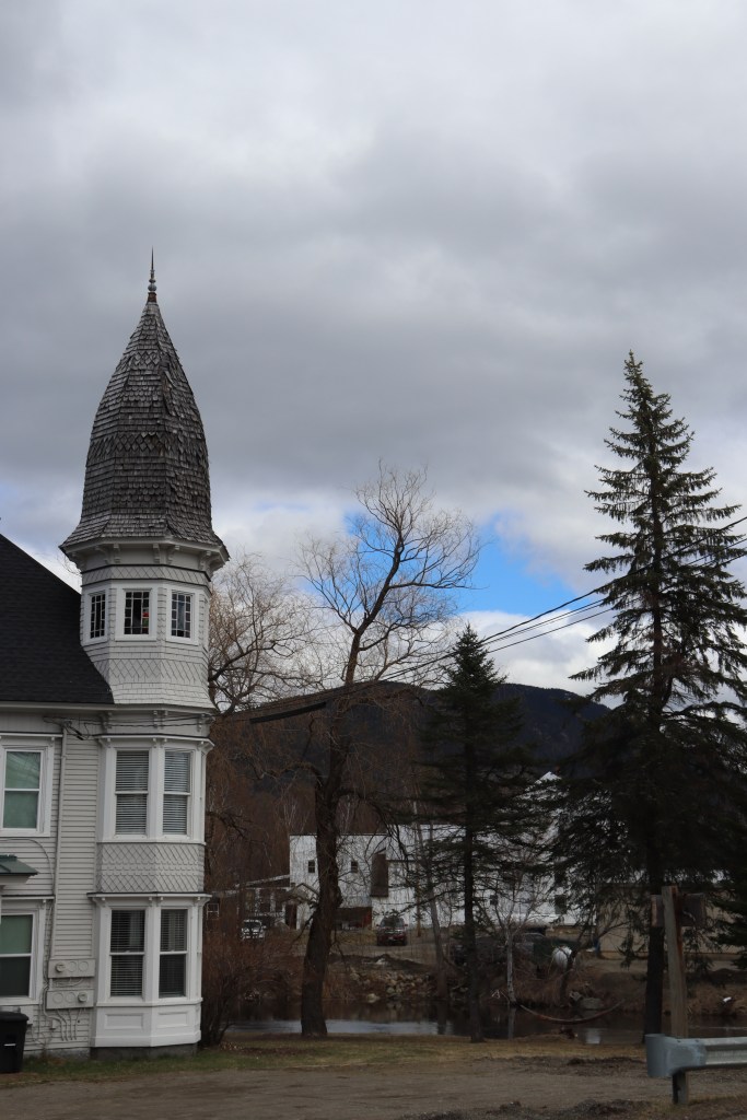
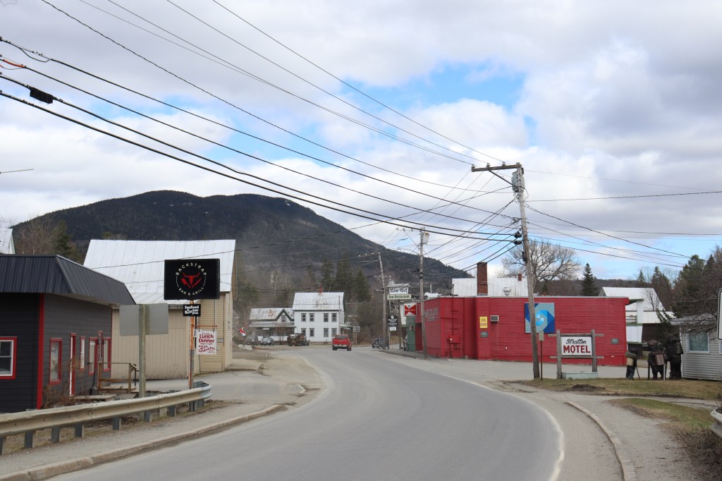
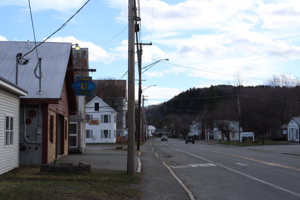
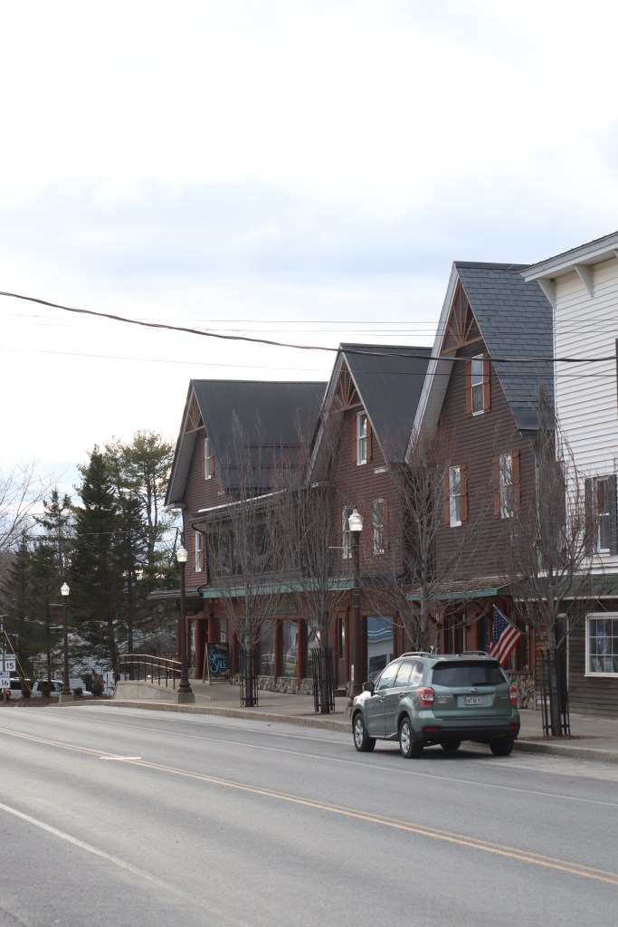
Stratton wasn’t even a place I looked twice at on the map when I first scanned this route before travelling, but upon visiting, this may well be one of my favorite little communities in Maine. With mountains to the east and the Stratton Brook passing through it, it was first and foremost the unique architecture of this town that caught my attention. The town has a lot of color, and many of the buildings are shaped like nothing else I’ve seen in this state.
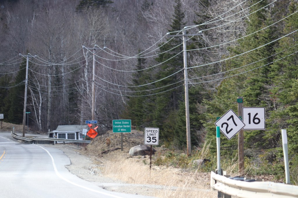
From here, Route 16 meets up with Route 27, and will run in tandem with it for about 20 miles. But along this stretch of road is the most notable section of Route 16: Carrabassett Valley.
Carrabassett Valley
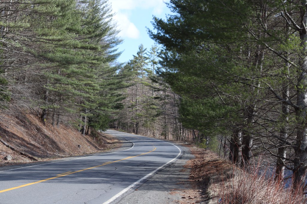
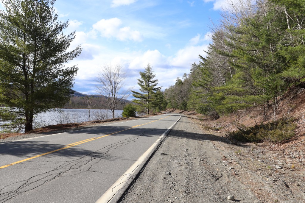
I stopped a lot on this stretch, as Carrabassett Valley is one of the most scenic mountain regions of Maine. Surrounded by mountains and following a rapids-filled river, there’s quite a bit to see here.
I started by stopping on a very recognizable trailhead. The Appalachian trail crosses Route 16 on the western border of Carrabassett Valley, on an uphill section of road. A few people are out on the trail today, but given there’s still snow on the ground, there’s not many.
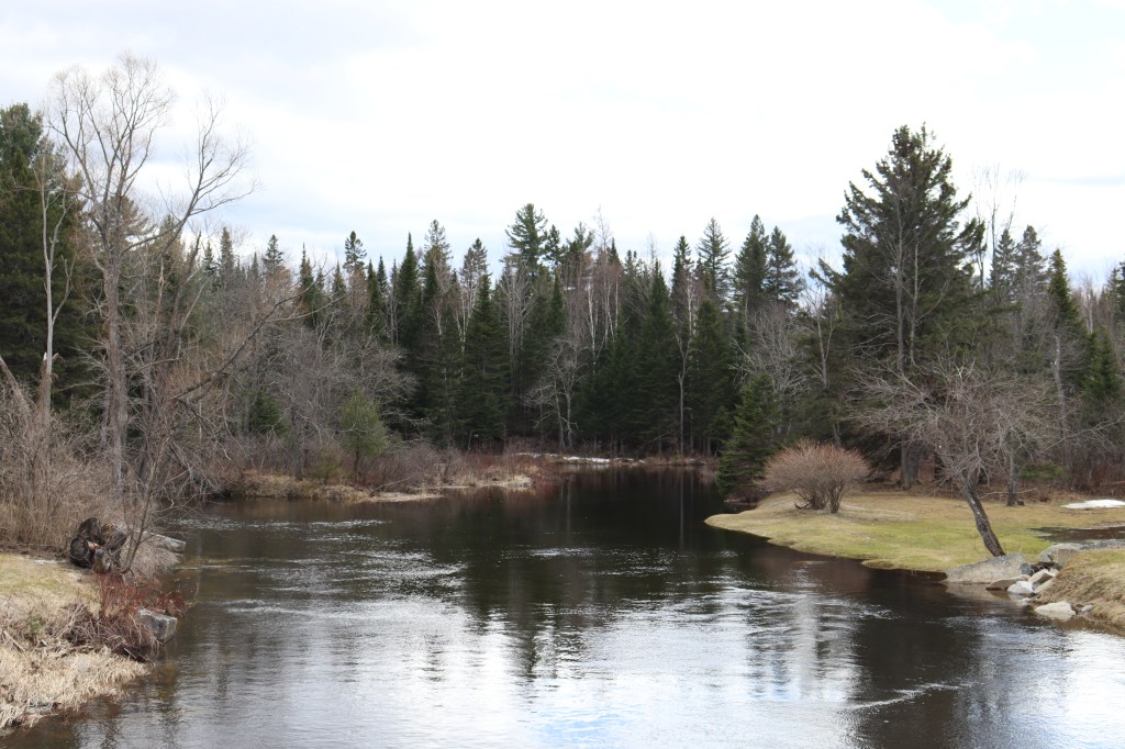
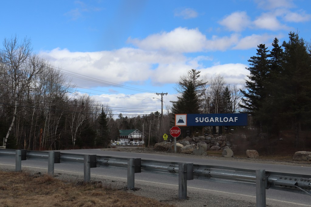
A bit deeper into the valley is Sugarloaf, Maine’s most popular skiing destination and the most recognizable part of Carrabassett. Though the mountain itself isn’t visible from the road, the small bridge by its entrance has a great view of the Carrabassett River and the road west from where we came.
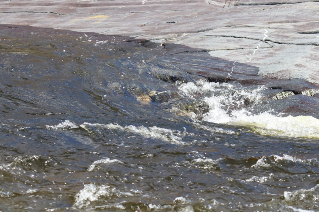
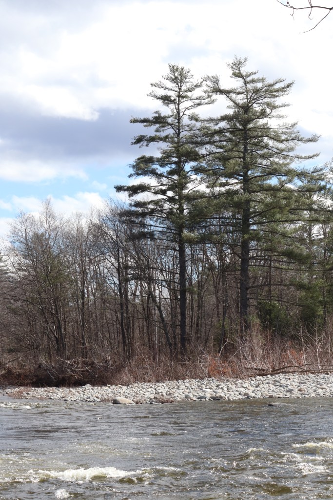
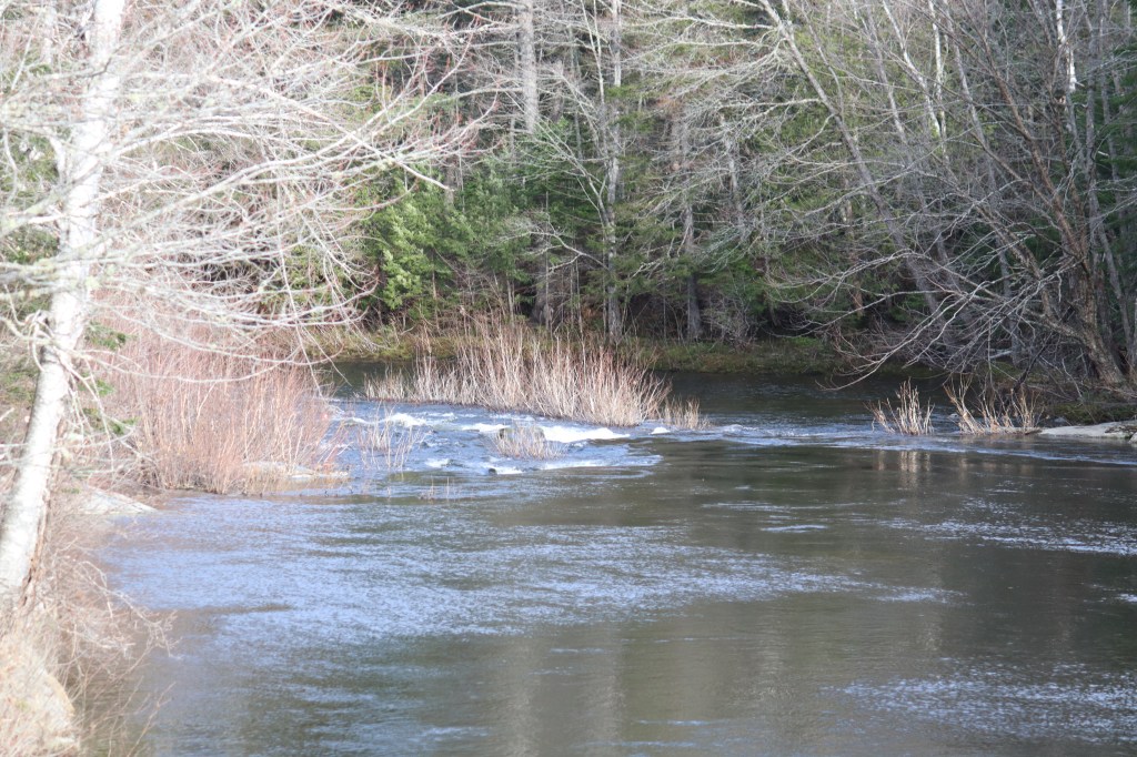
As I was leaving the valley, I found a small pull off and trailhead to the east in the rural north of Kingfield. This trail wasn’t marked, though it was clearly in occasional use, so I decided to follow it for a bit. It weaved down from the road right to the shore of the river, in the middle of a series of rapids. The shore was met with a smooth pebble beach, and there were trees growing out of a small island between a fork in the flow. This spot was incredible, surrounded by mountains and far enough away from the road that all you could hear was water and birds. This is definitely a spot I’d recommend if you find yourself in the Carrabassett region.


Kingfield
Getting into Kingfield proper, I found myself met with a really interesting combination of inspirations for a Maine town. This was mostly a classically-styled New England town, but since it’s so close to Sugarloaf and Maine’s ski country, it has a distinctly alpine undertone in its architecture.
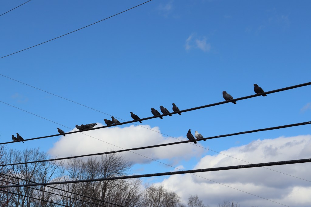
I walked out over the Centennial Bridge to look back over the Carrabassett Valley once more. Birds lined the telephone wires like an audience, all looking out towards the mountains of the west. And beautiful as it was, the road continues east, and I’m following.


Anson
For a while, Route 16 breaks away from the Carrabassett River to go north through the village of North New Portland. But it connects with it one last time as the Carrabassett drains into the Kennebec in the town of Anson.
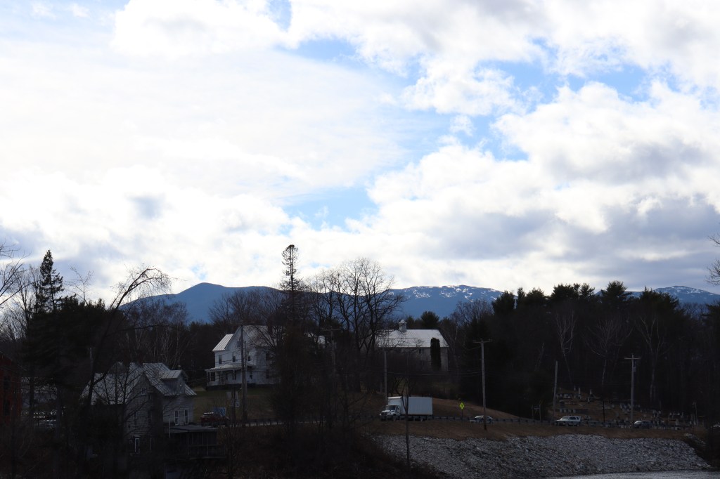
To be more specific, Route 16 passes through the village of North Anson, a few miles north of the mill town across from Madison. This is another small village, but one with a beautiful view of the end of the Carrabassett as it splays out into a small delta before meeting the Kennebec. North Anson may be small, but it marks a major turning point into the second valley of the day: the Kennebec Valley.


Northern Kennebec Valley
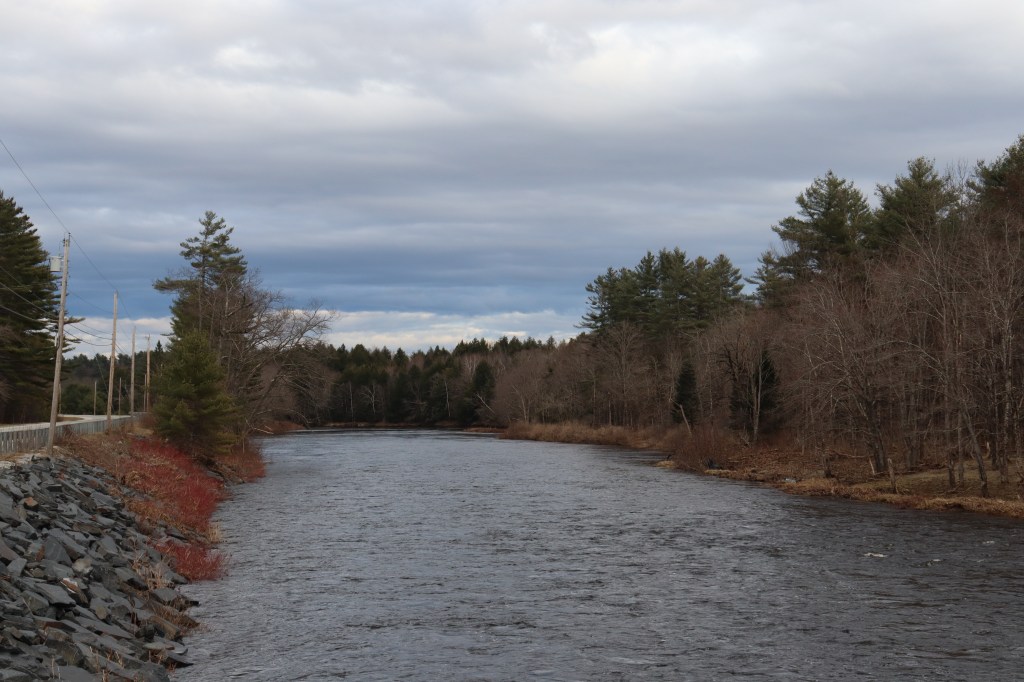
Route 16 follows the Kennebec for a little while here, passing through the small communities of Embden, Concord, and Pleasant Ridge. Though most traffic up Kennebec Valley goes along Route 201 on the eastern shore, Route 16 passes through the far less populated west until Bingham.
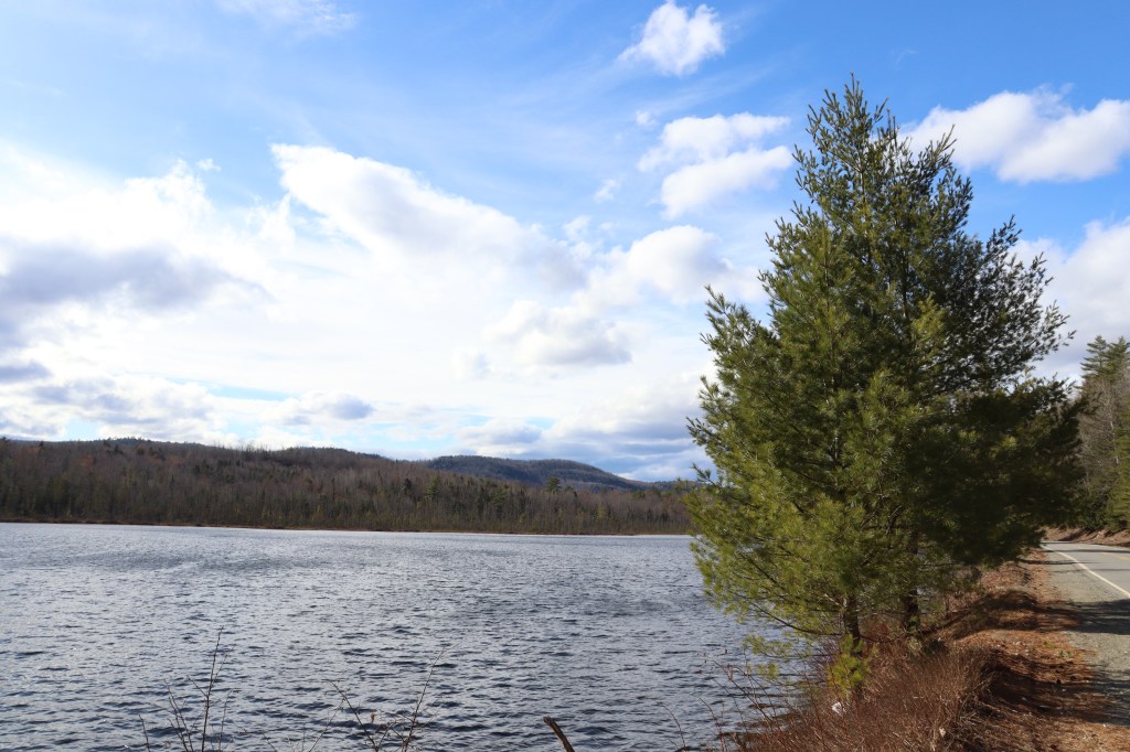
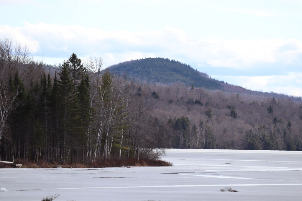
In the township of Concord, I stopped along Lily Pond, a nice little remote lake overlooking the small hills northwest of Solon. Being so remote, it felt as though no one had stepped foot near this lake in years. Places like this are the kinds of discoveries I love to see on One Roads.
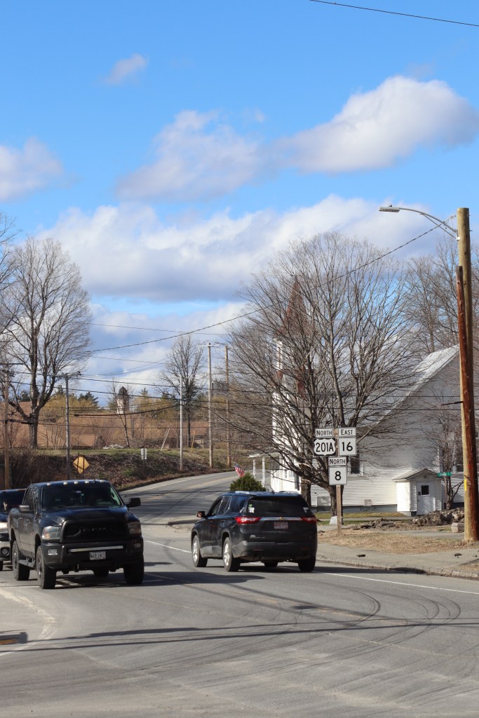
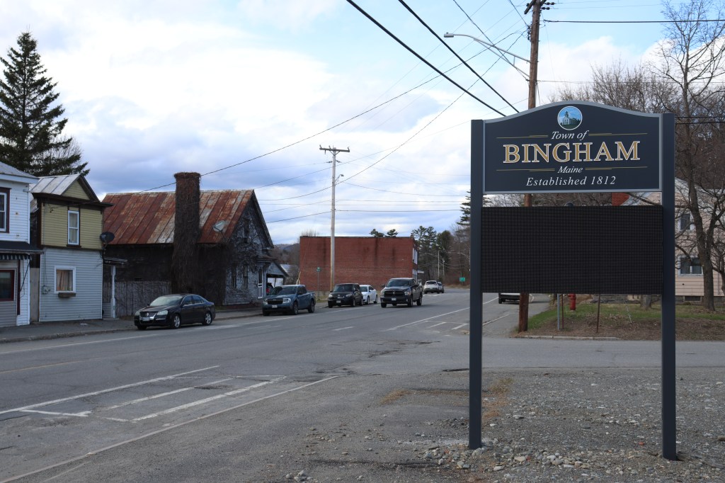
When Route 16 crosses back to the east side of the Kennebec River, it does so on the border between the towns of Bingham and Moscow. Bingham is a little more populated than what we’ve seen so far on this road, but still stands as far smaller than anything seen in the state’s more southern regions. But even this small hint of human interaction won’t last, as Route 16 is about to move into its emptiest region yet.

Mayfield Corner Region
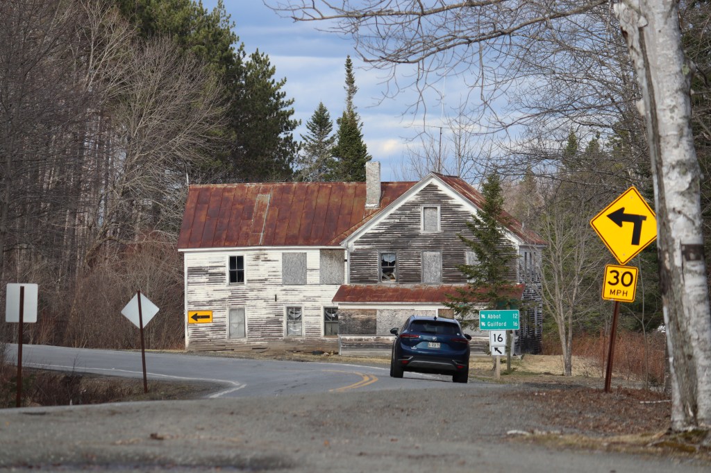
The region in which Route 16 passes between the Kennebec Valley and the Piscataquis Valley doesn’t really have a name, as there’s no established towns between Moscow and Abbot. But even without a name, this is one of the most beautiful places in the state.
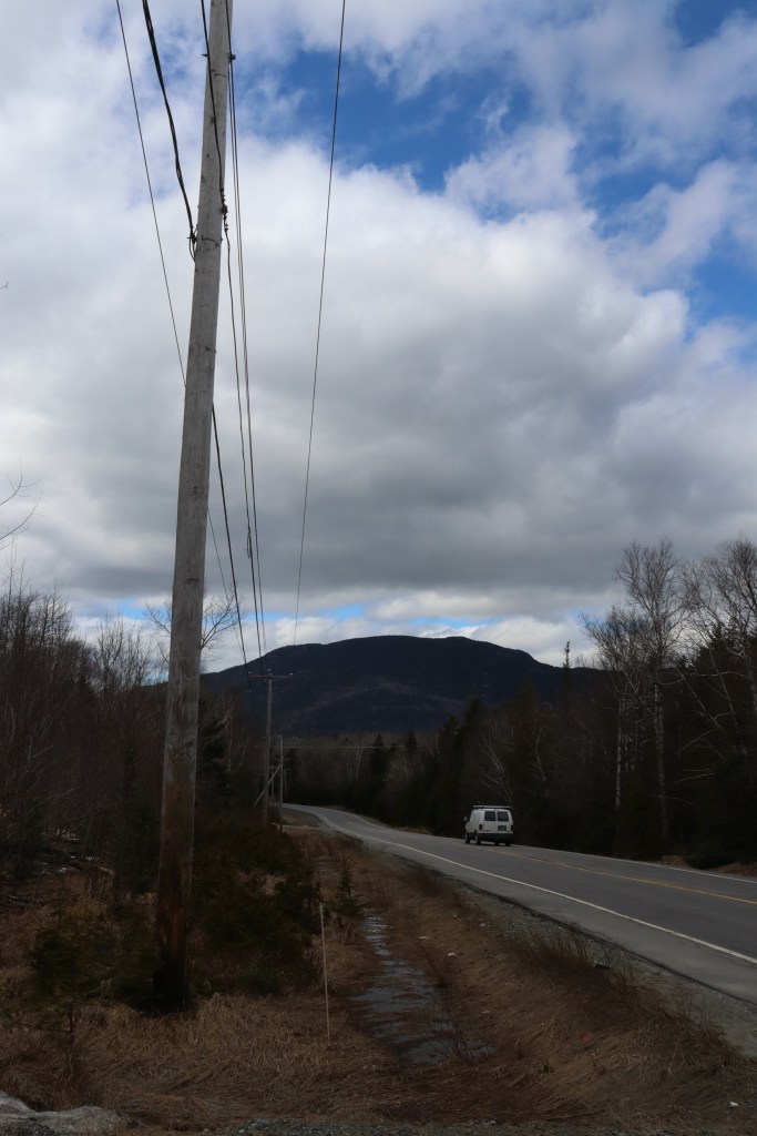
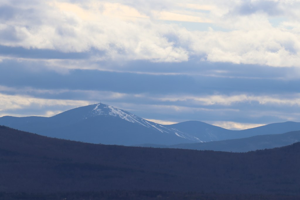
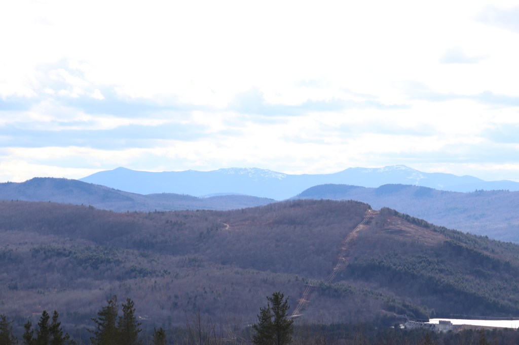
The one notable geographic point of this section is its junction with the start of Maine Route 151, at what is colloquially known as “Mayfield Corner.” As of 2020, this entire region has a population of merely 28. And I can’t believe more people haven’t found this place. The road travels up a line of mountains in the northern Appalachians that looks back west into an incredible landscape of Maine’s entire Lakes and Mountains region, that is a sight to behold on a day as clear as this one.
Crossing into Kingsbury Plantation, I passed Kingsbury Pond to the south to get one more look at the mountains west. I’m finding myself having trouble putting into words just how beautiful this area was. The pictures speak for themselves.

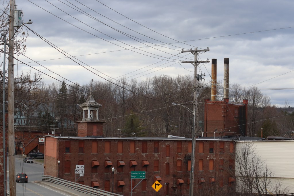
Piscataquis Mill Towns
From Abbot to Milo, Maine Route 16 follows the exact same path as Maine Route 6, another route I drove for One Road just a month before this. As such, I didn’t want to retread old ground and take the same pictures, so I went out of my way to find some unique spots I missed on the first go.
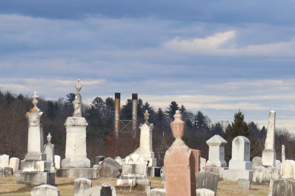
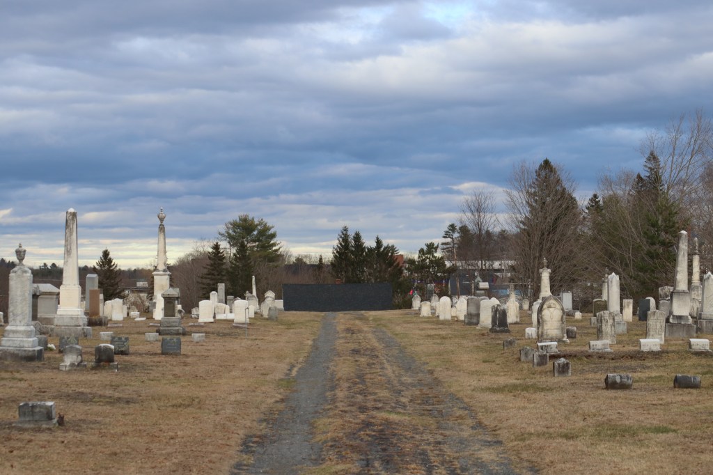
In Guilford, I hiked up to the Elmwood Cemetery, a graveyard on the highest point in town overlooking the mill to the east. Here, I got a beautiful spanning view of the whole town, one I didn’t think was possible to find on my first drive through on Route 6.
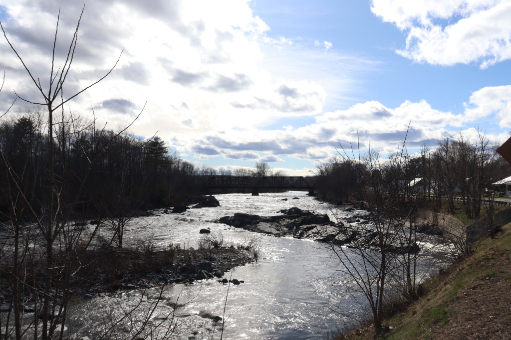
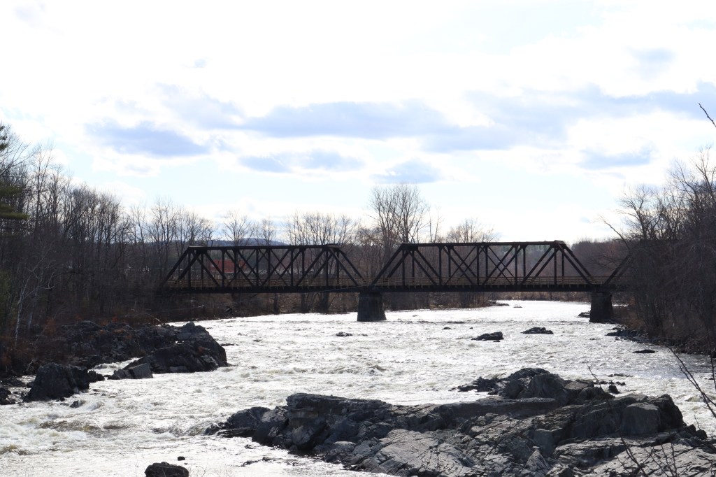
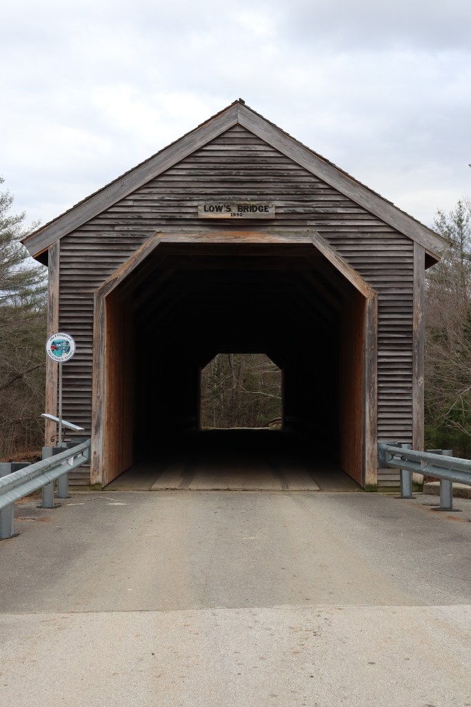
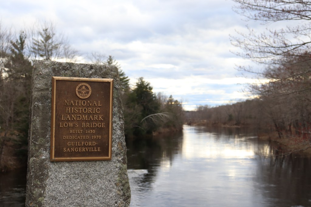
On the border of Sangerville to the south of Route 16, I stopped at Low’s Covered Bridge. This bridge has a significant history to Piscataquis County, being an early stepping stone in connecting the towns of the region.
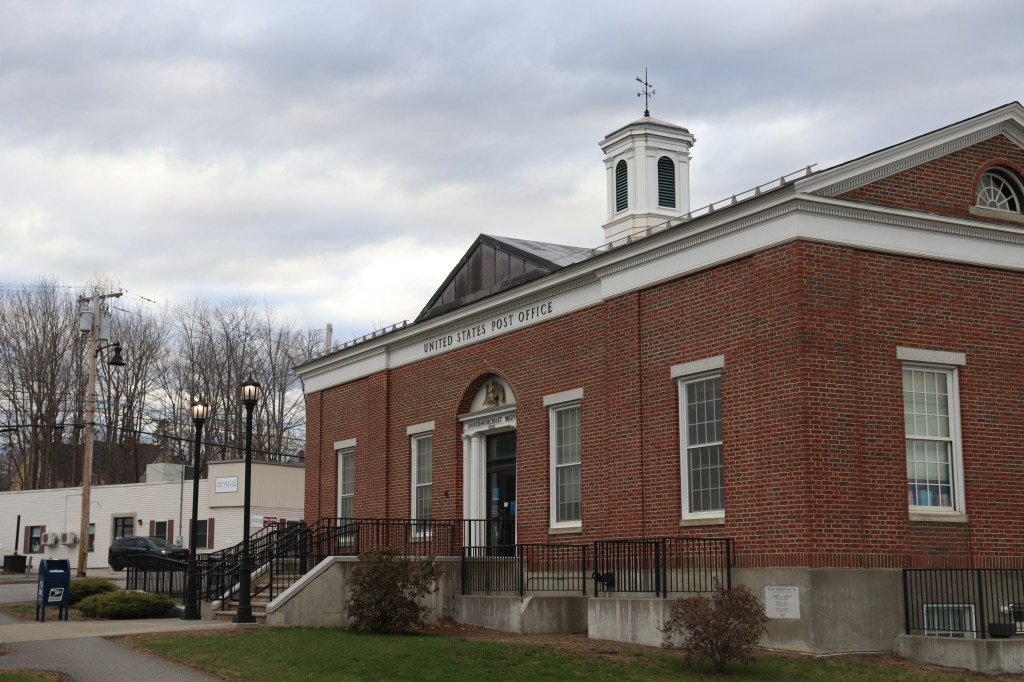
And in Dover-Foxcroft, I took my time to walk up to the town’s immaculate post office, with a unique facade I never got the chance to fully appreciate.

Penobscot River Valley
Past Milo, Route 16 splits away from Route 6 and goes south, passing through the farm towns of Lagrange and Alton.
The road is very forested, and doesn’t have nearly as many clear views as prior. But that doesn’t mean the road isn’t pretty. Through the trees to the east, I caught several glimpses of Passadumkeag and its prominent mountains. on the opposite side of the Penobscot.
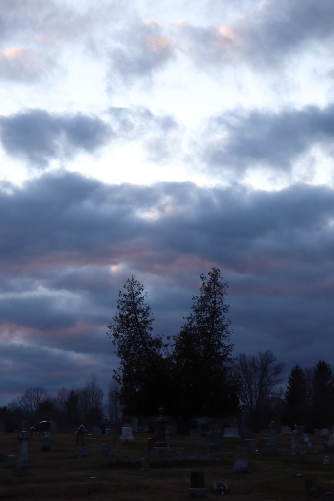
Upon reaching Old Town, and entering the Bangor metropolitan area, I stopped one more time at a cemetery just on the border with Orono. These two trees caught my eye from the road, and with the dusk clouds above, I saw a visual story I had to tell.
Orono
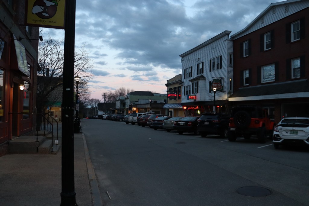
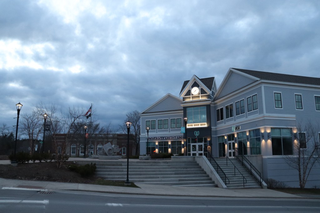
And at the end of the road, we come up to the downtown center of the college town of Orono.
The University of Maine is based here, and that fact leads its downtown to being one of the busiest in the state. Being sunset, the restaurants of main street are hopping with customers, and the dining room windows light up the street. Now back on US 2, the first One Road I drove, I take a moment to sit and reflect on this similar 2-day journey, now across two states.

Leave a comment