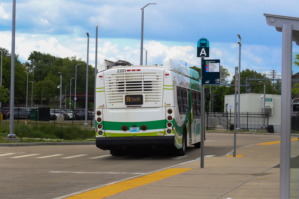
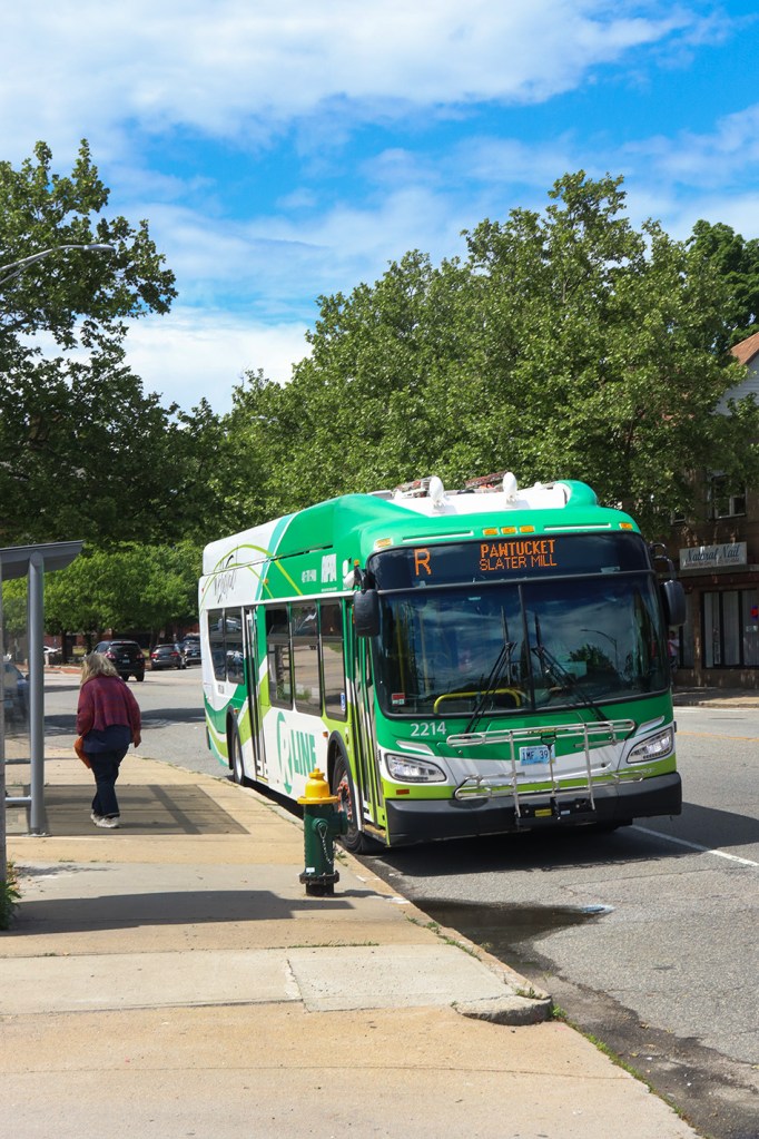
The R Line is the crown jewel route of Rhode Island’s transit network, RIPTA. It connects the densest commuter stretch of Greater Providence across three cities, takes as close to a direct route as possible through each, and has by far the best frequency of any bus in the system. It runs regularly once every 10 minutes, which is incredibly often for a local bus and is even better than parts of the MBTA’s Silver Line. The Miles In Transit blog gave this route a rare 10/10 for its service over a decade ago, and in terms of speed and ridership, it’s certainly just as useful today. But we’re not just here to talk about how the route works. We’re here to see what sights you can find along it.
I took this bus on a Thursday in late May with my friend and fellow transit enthusiast Shen. It was mostly sunny on this day, although we had some spontaneous rain during our trip. Being honest and breaking character a bit here, this trip was absolutely just an excuse to take a daytrip and explore Providence. It’s always been one of my favorite cities in New England, especially for its beautiful downtown stretch with a variety of skyscrapers and historic buildings. But until now, I’d never actually been on transit in Providence. The great thing about taking the bus is that you can get so much more engrossed in the culture of a city, and maybe even meet some locals along the way. We decided to follow the route using a combination of taking the bus and walking, switching modes at each of its 10 major stops.
This is our journey down the RIPTA R Line.
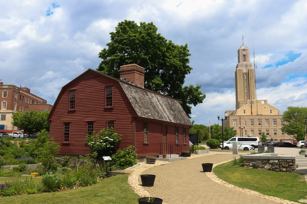
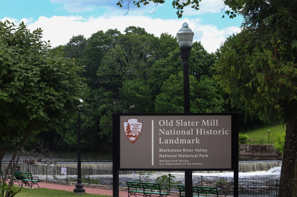
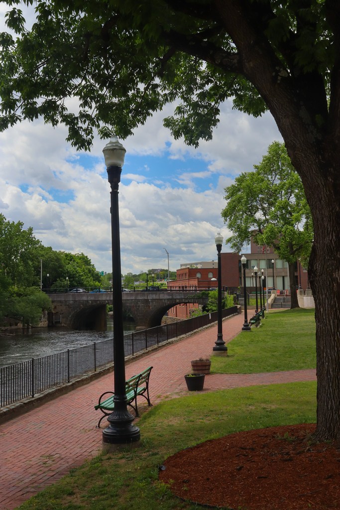
Slater Mill
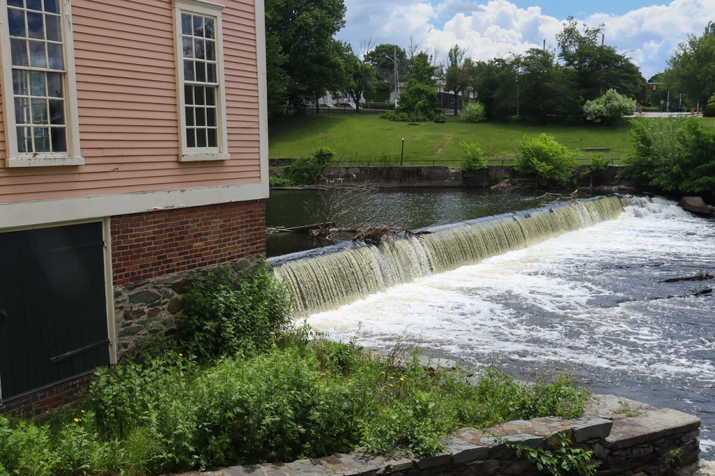
The R Line begins in Pawtucket in front of what is perhaps the city’s most beautiful landmark: the Blackstone River Valley National Historical Park. While the park extends along the river to the northwest and deep into central Massachusetts, Pawtucket’s section acts as its starting point and informational center. Pawtucket Falls, Wilkinson Mill, and of course the titular Old Slater Mill all sit right beside the bus stop along a small green space and walking path. This was an incredible starting point for our trip.
Across the river, there was one particular building poking up from the trees that caught my attention. This building had a large wire-frame pyramid atop it, and at first I thought it was a stadium of some sort. In fact, taking a look at nearby snapshots on Google Maps made me almost sure it was an event venue. As it turns out, the pyramid building is actually a locally famous abandoned department store built in the 1960s known as Apex, which closed sometime around 2001. Over the past year, the city has been passing around the idea of demolishing the property entirely, so this may well be one of the last pictures anyone will get of the old Apex Building.
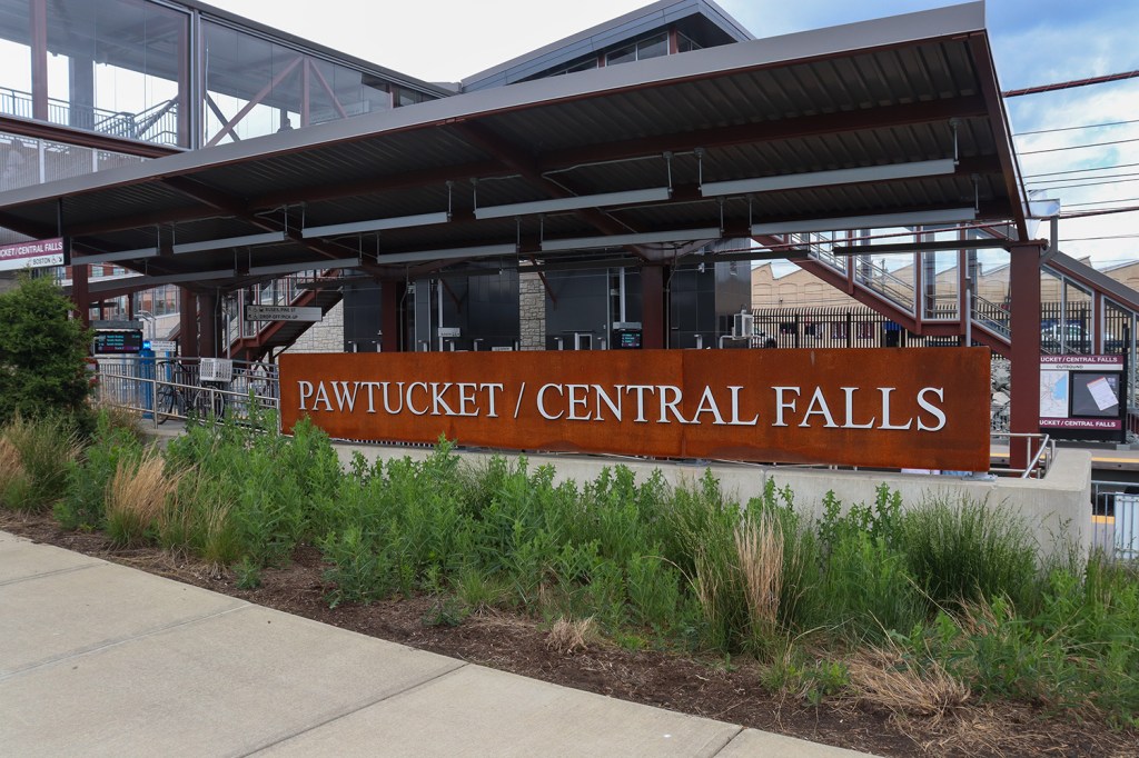
Pawtucket-Central Falls
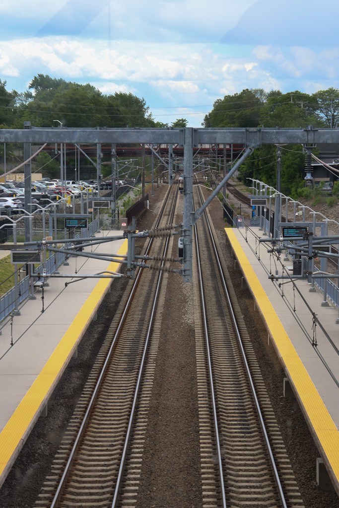
Here, the R Line meets up with the MBTA at the first of Rhode Island’s four Commuter Rail stations on the Providence Line. There weren’t any trains coming in while we were here unfortunately, but being a northern hub for Providence’s transit system, there were plenty of buses picking up and dropping off passengers from multiple routes.
We wandered around the station for a little while, and eventually went up to the elevated concourse to get a much better view of the area. Unfortunately, it’s not high enough to see the Providence skyline from here, but we were able to get a much better look at the tracks and all of the attached wires and overhangs stretching southwest down the rail.
Collyer Park
Collyer Park is a very short walk from Pawtucket Station, and there’s not too much to say about it. This is a fairly industrial part of the city, but the park itself offers a nice bit of nature in between the mills and auto repair shops.
From here, we grabbed the bus again and started off down Pawtucket’s Main Street to our next major stop.
Ninth Street
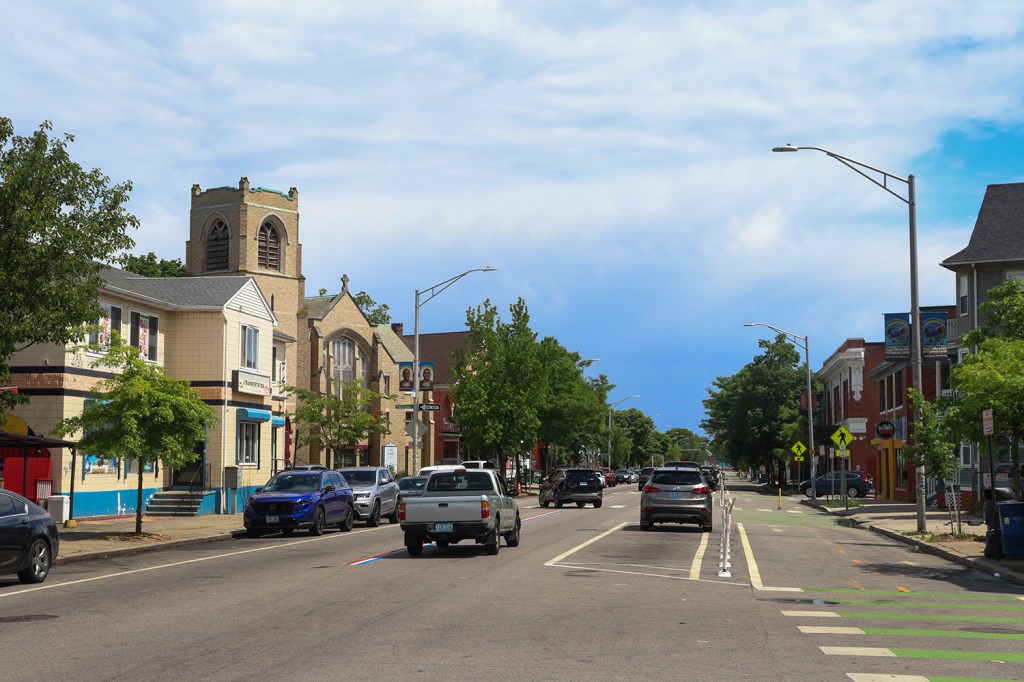
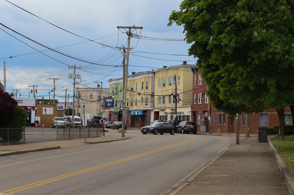
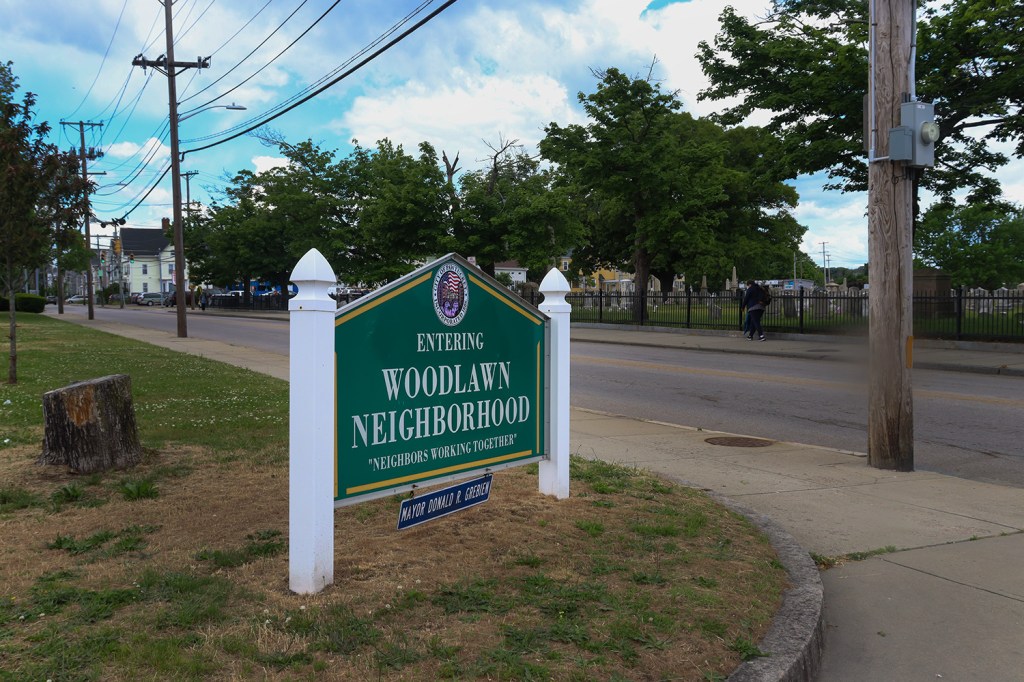
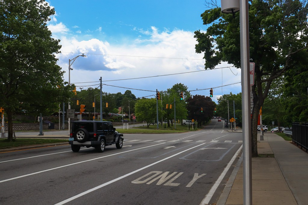
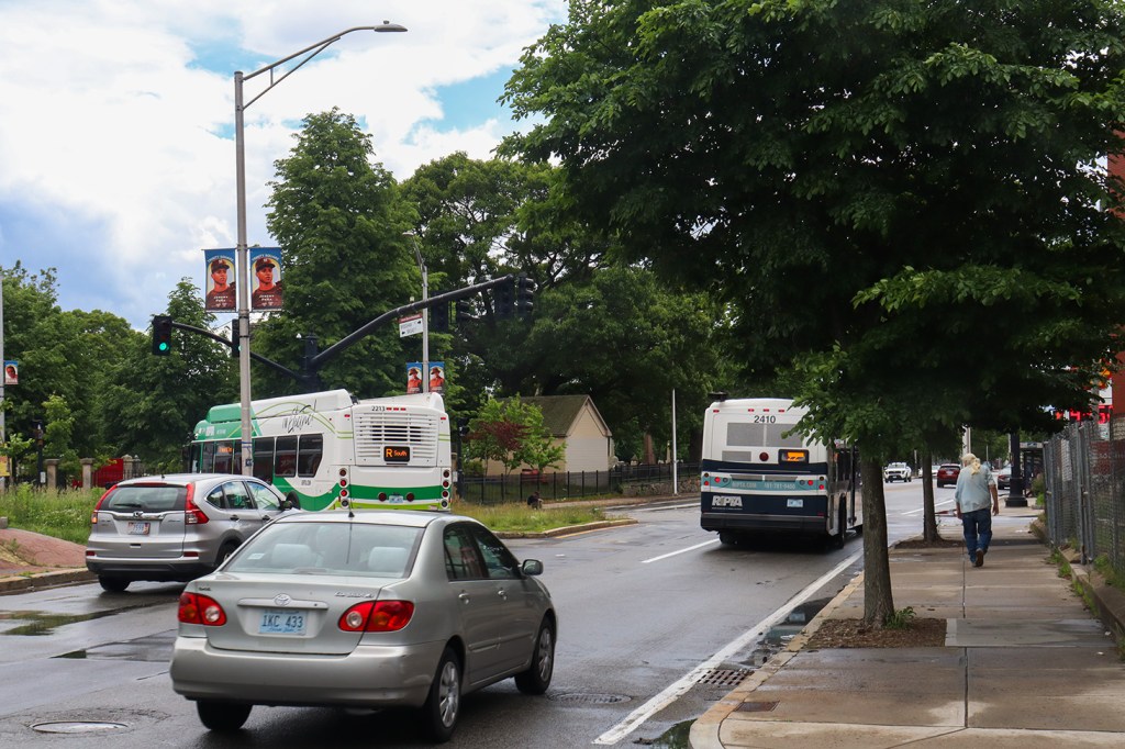
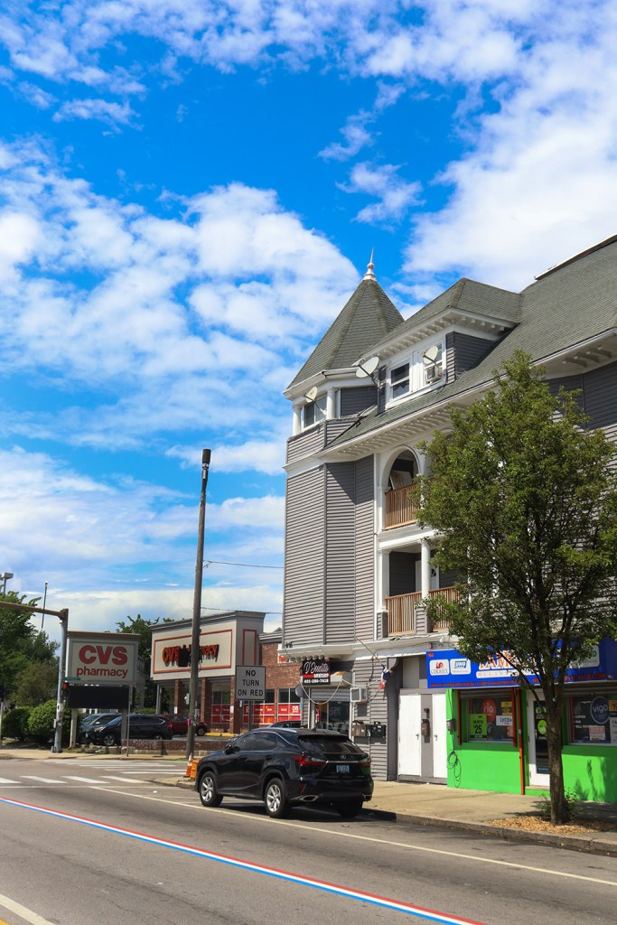
After the bus took us through the neighborhood of Woodlawn, Main St. connected up with US-1 and we reached our next stop at the intersection of 9th St. This was the beginning of our longest stretch of walking between the major stops at a little over a mile long.
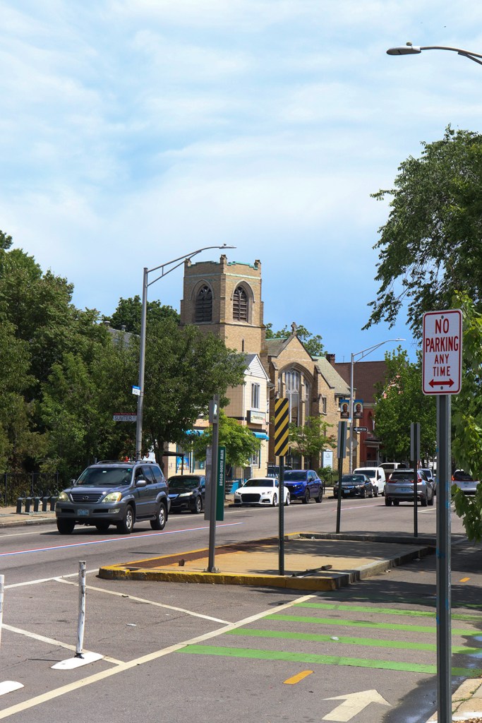
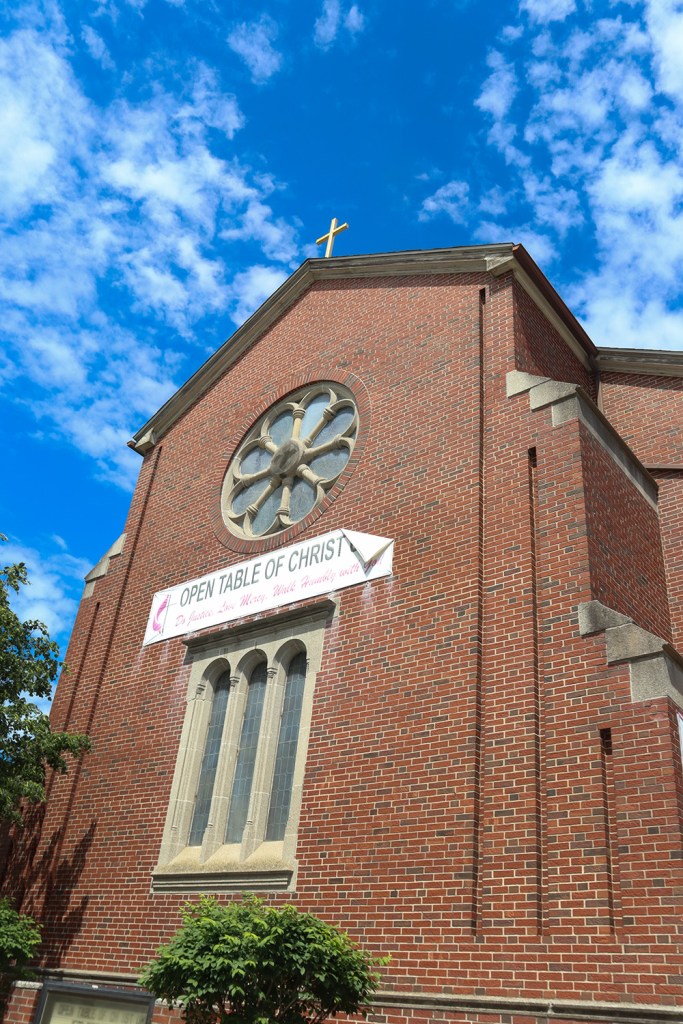
The Ninth Street station is our first stop over the border of Providence, but it will still be a little bit before we get to the recognizable center of the city. This station and its neighbors serve a large residential community to the northeast, as well as a number of commercial blocks and churches along Route 1.
Charlesgate
Our walk down Route 1 took us right beside the North Burial Ground, a historic cemetery that was in full bloom this week, as Memorial Day was only three days before we took this route. But our next stop was still a bit south of this, in the neighborhood of Mt. Hope.
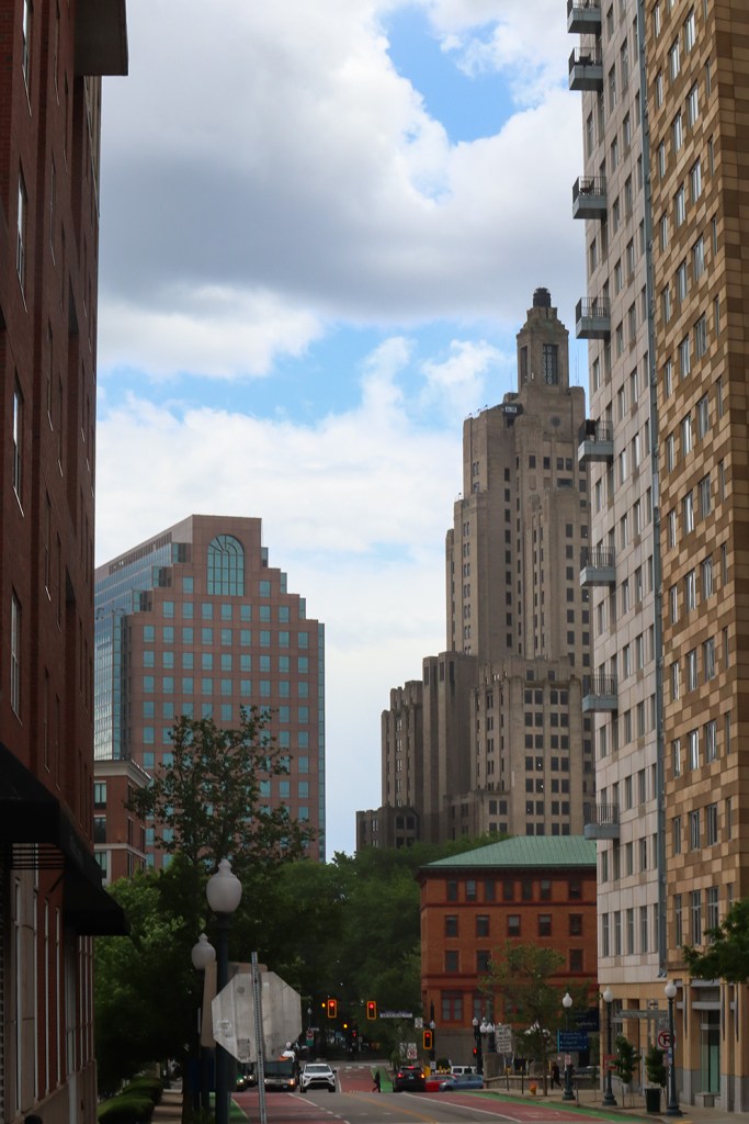
The urban sprawl of Providence’s downtown was beginning to become more visible as we went further south, but the city has chosen to combat this by maintaining a ton of greenery along its major roads. The Charlesgate Apartments, the namesake of this station, are a great example of this, as it almost looks like a forested road surrounding the building from the ground level.
While we still can’t see downtown Providence from here, we’re actually within a half mile of it. Our next station will lead us right into the city’s center.
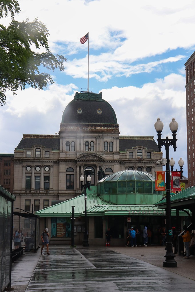
Providence Station
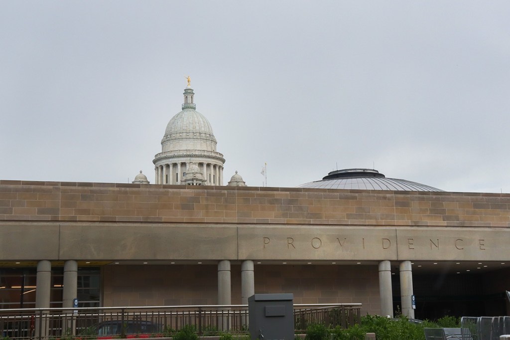
And here we are – the purpose of this whole trip! Providence Station is the train hub of Rhode Island, acting as the largest of the state’s three Amtrak stations and the (weekend) terminus of the MBTA’s Commuter Rail. More importantly for our trip though, this is our first stop in the center of Rhode Island’s capital.
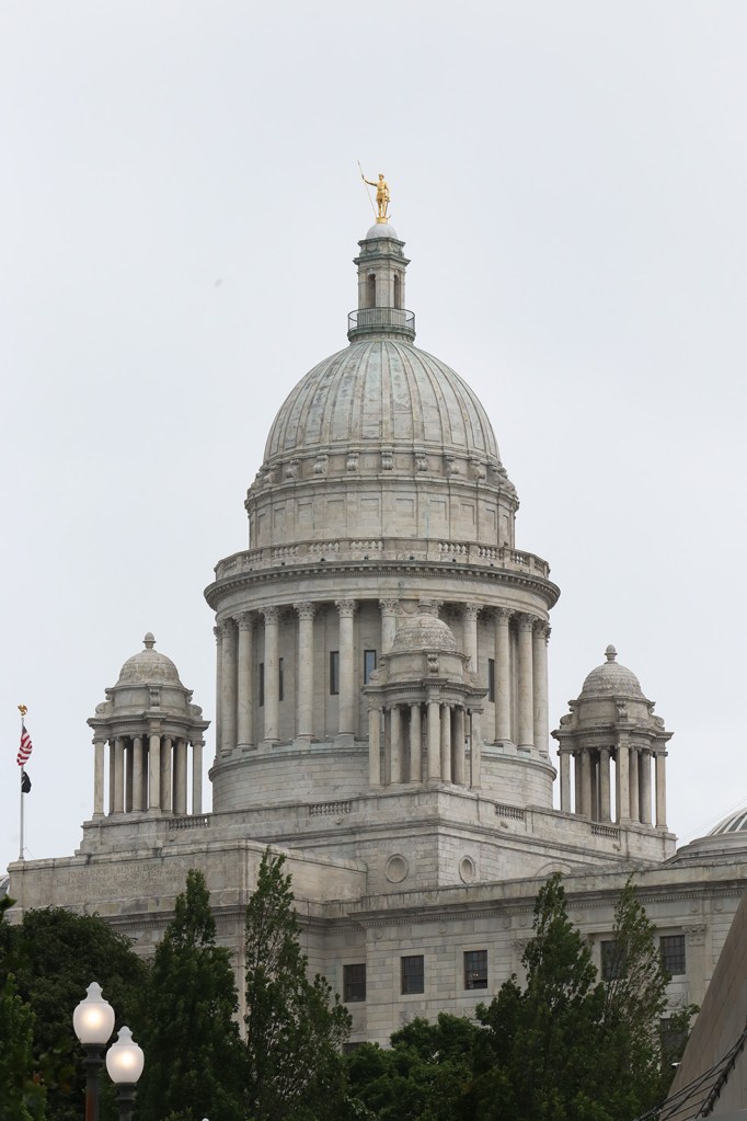
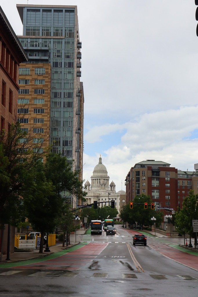
The station itself sits on the same common as the state capitol building. Surprisingly, this actually marks the first capitol we’ve visited so far on One Road! We’re starting strong, as (spoiler alert) this is my personal favorite of New England’s state capitols. It’s a gargantuan building on a hill overlooking the city, surrounded by trees and visible from virtually everywhere around here. And while it sticks close to the Roman-inspired design of most American dome capitols, Rhode Island’s is the one I feel pulls off that design best.
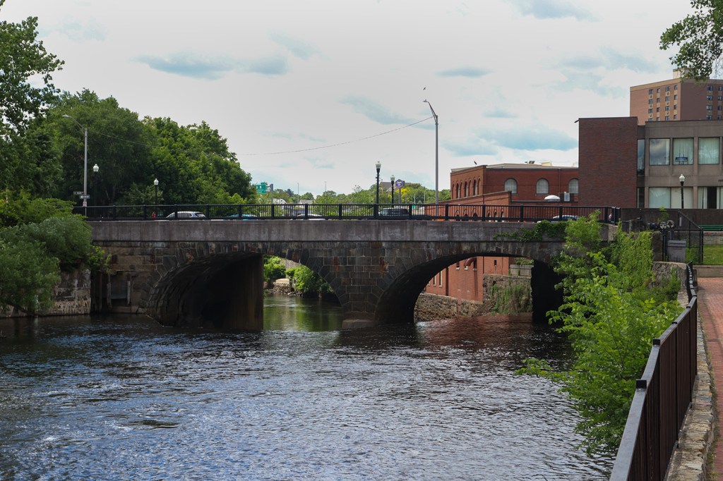
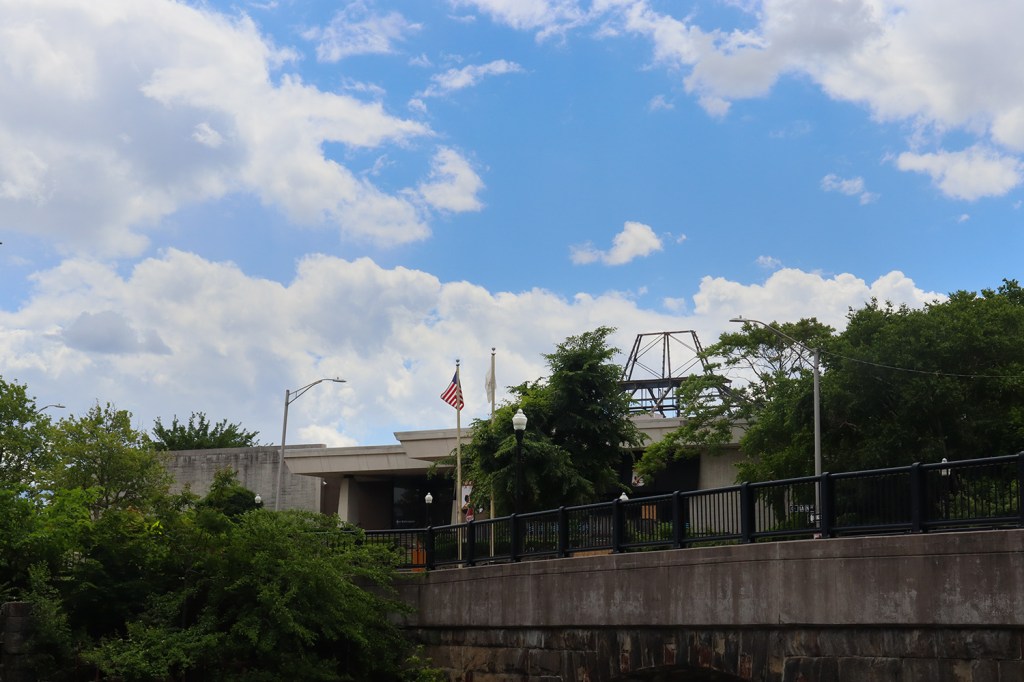
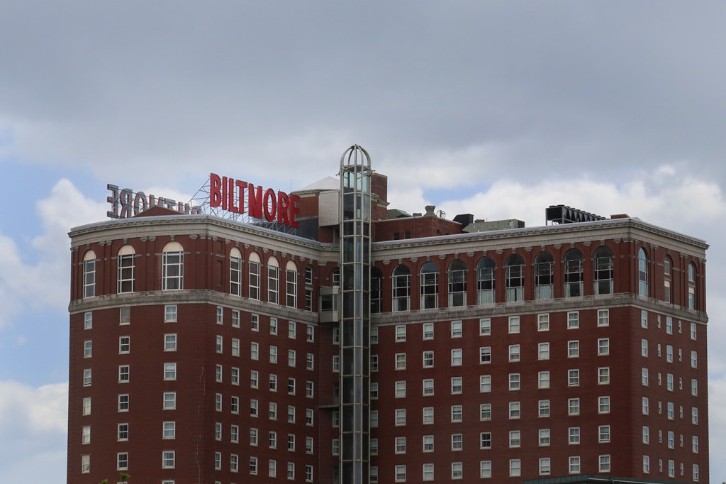
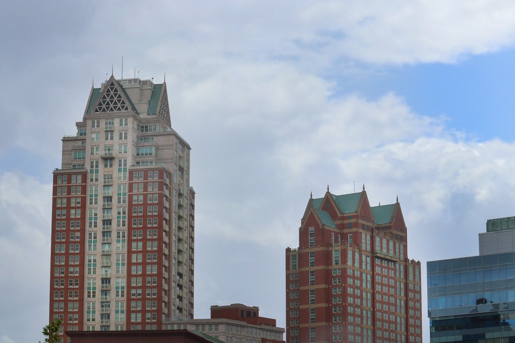
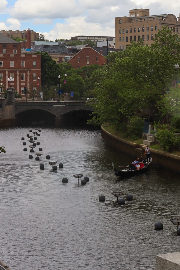
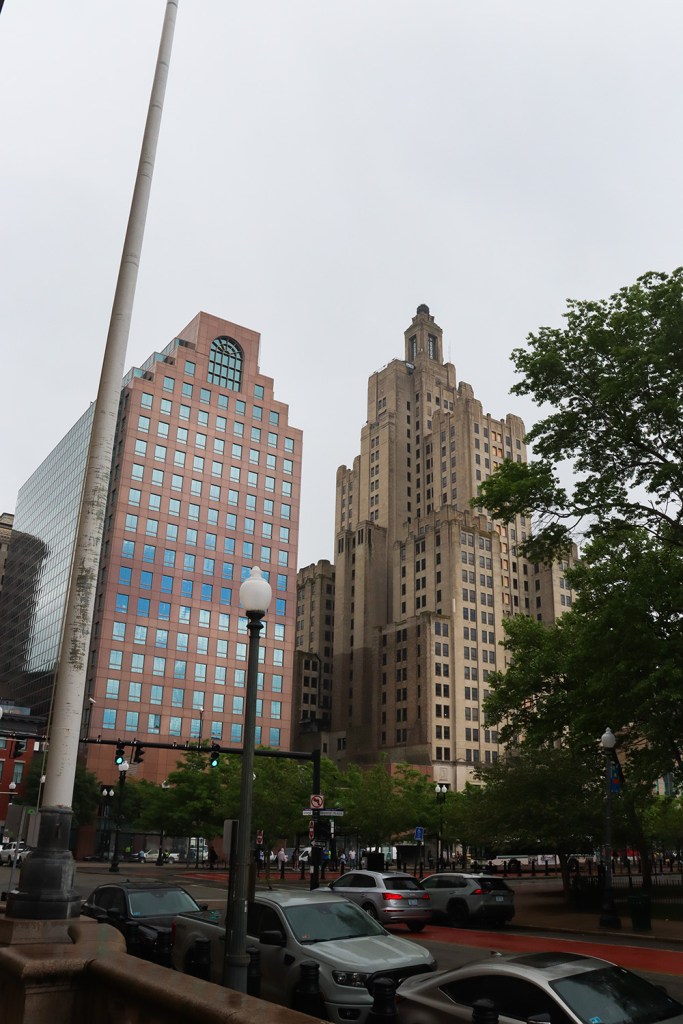
Looking south, we can finally see all of the high rises and skyscrapers Providence is known for, including the iconic Biltmore Hotel building. And below, several gondolas line the scenic Providence River. It’s a short walk to our next major stop now, and once we’ve crossed this river, we’re just about there.
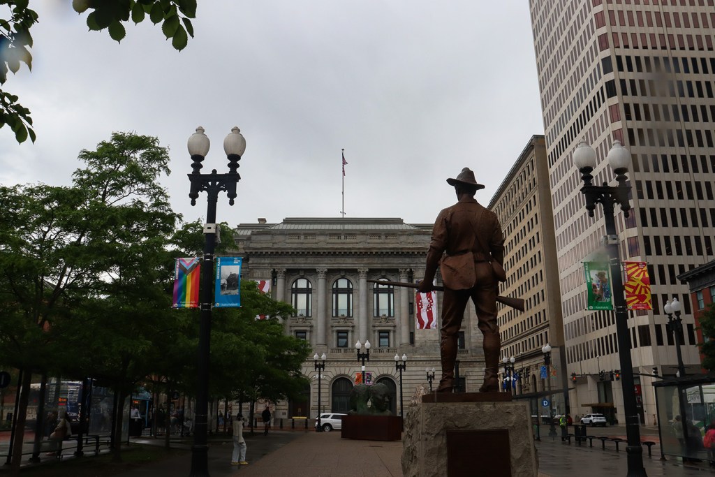
Kennedy Plaza
While Providence Station is the train hub of the state, Kennedy Plaza is just that for buses. In a largely open platform between the Burnside and Biltmore parks, this hub services a whopping 52 bus routes across the RIPTA system!
The rain started a bit here while we were waiting for the bus, but that didn’t stop us from continuing to take in the sights. Providence’s city hall, the local post office building, and the Kennedy Plaza Business Center all tower over the platform, but one of the most interesting sights may be the Kennedy Plaza terminal building itself. It has a concrete and iron design with lots of windows and lots of green, very reminiscent of the classic transit buildings you’d see across Boston and New York’s subway systems.
From here, we got on a quite crowded R Line bus south out of downtown, and got ready to head to our last big walk of the day.
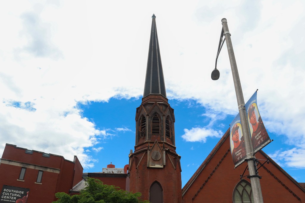
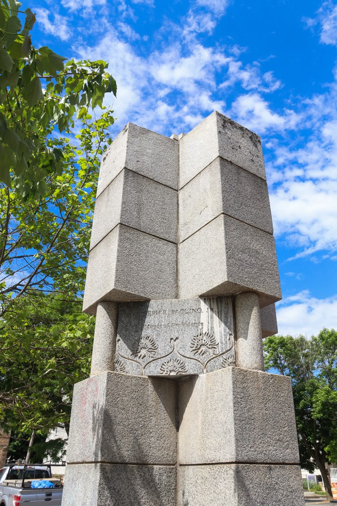
Trinity Square
Trinity Square sits right between three of Providence’s southern residential neighborhoods – Upper South Providence, the West End, and Elmwood. We didn’t get to spend too much time here unfortunately, as we still had about another mile of walking before we got to our penultimate stop.
We did get to admire Trinity Square’s Southside Cultural Center towering above the colorful intersection. While the top of its steeple has certainly seen better days, the inside is still an active and vibrant center for the arts. I’d love to come back here and visit it properly next time, perhaps even for one of their periodic community events.
There is a bit of a strange extra piece I’d like to bring up in this section that’s not quite connected to the stop itself. As we were walking past the southern end of the Grace Church Cemetery on our way to the next stop, we spotted a large yellow sign that acted as a live broadcasting booth for one of Providence’s public radio stations! It had two microphones and instructions to just start talking to basically let passersby host their own radio shows. I seriously regret not taking a picture of the machine, as for the life of me I cannot find evidence of the station that runs this program anywhere online. It’s a really cool idea for public interest content, so if you know anything about the program, please let us know through a comment or email and we’ll feature it in next month’s update post!
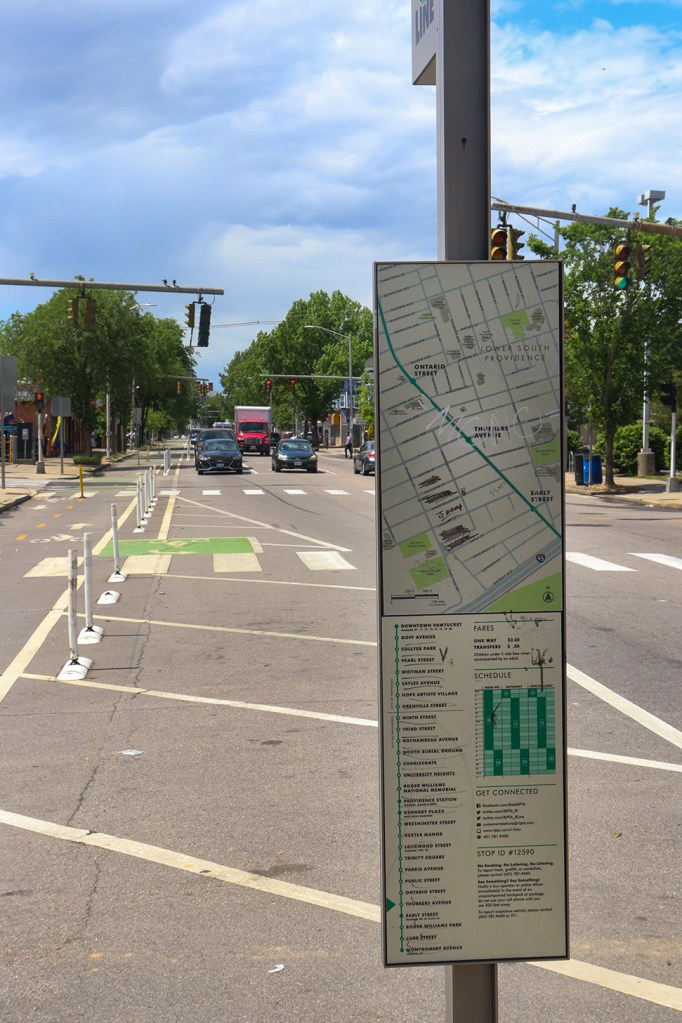
Thurbers Avenue
Into the Lower South Providence neighborhood now, we reached our next station on the R Line. We luckily made pretty good time walking from the previous stop, so we had a few minutes to look around before our last bus of the day arrived.
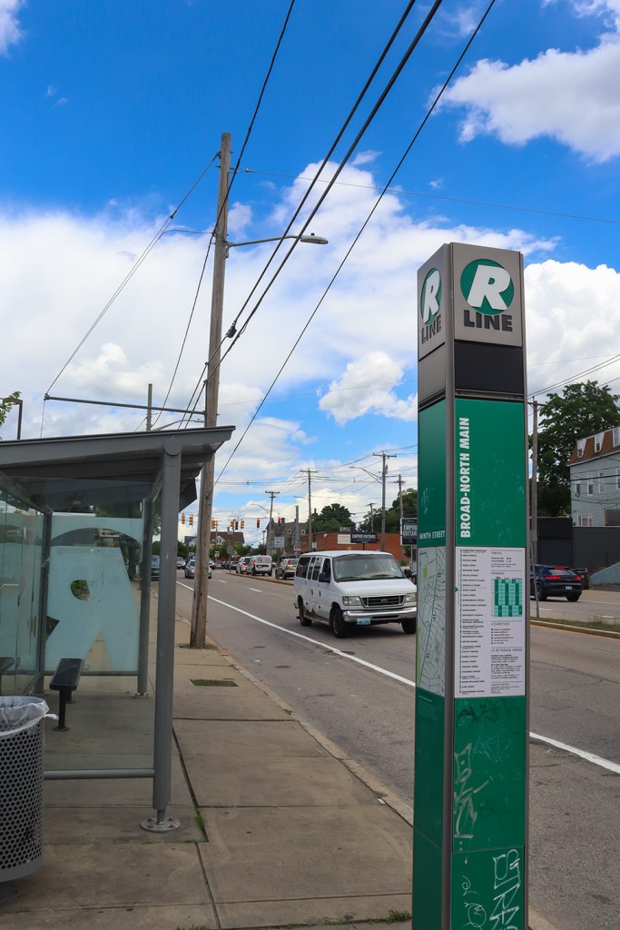
This station has one of the most unique platforms I’ve ever seen, and that’s not necessarily for good reason. It’s basically a concrete pad that juts out on its own little island in the middle of the street. On a positive note, it does make space for the nearby bike lane and seems like it effectively slows down traffic to make Broad Street safer for pedestrians and bus riders. The problem though is this is the only major stop on the R Line to have no benches or shelter for people waiting! Even the signage is lacking, as there’s only a small pole with the route sign here (compared to the large green pillars seen at virtually every other stop on the route).
We wouldn’t have to stay here for too long though, as we were on the way to our final stop at the end of Providence.
Broad Street Terminus
The Broad Street terminus stop, also listed as Montgomery Ave, sits right on the border of Cranston. This acts as a connection to Providence’s largest suburb, as it matches up with RIPTA Line 1 to TF Green Airport.
The R Line is, overall, a very unique way to experience Providence as a non-local. It is an incredibly useful commuter connection for the people of Providence, but I will echo what was said in the aforementioned Miles In Transit post in that this is certainly not a touristy route. That being said, we genuinely did have a lot of fun exploring the parts of the city that are glossed over by local guidebooks (alongside the usual hotspots, like downtown and Old Slater Mill). It was a great way to see a city that I’ve always wanted to spend more time in.
In the next post, we’re staying on the bus and heading up to a coastal commuter route with some surprisingly beautiful views – that’s just a short trip north of Boston.
Written and Photographed by Rin Gately. Edited by Keith Libby.

Leave a comment