I always love a good excuse to explore Boston! It’s been a few months since we were last in the city, but I think it’s time we took a look at it from a new perspective.
Beacon Street is one of Boston’s most integral streets, acting as the historical corridor connecting the western metro with Beacon Hill and the state capitol. It runs along a mostly straight stretch of just over 10 miles, winding a little bit around its highest point on Chestnut Hill. I walked this road on my own on a very clear day in mid-October, meaning that the foliage was, luckily, still well into its most vibrant season!
This is my journey down Beacon Street.

Waban
Beacon Street starts just a few hundred feet from the Woodland exit of Route 128, the main beltway that encloses a majority of greater Boston. We’re comfortably at the outskirts of the metro area here!
This western section of Newton also marks the western reaches of the village of Waban. The city of Newton is comprised of 13 distinct villages, many of which are connected via the MBTA Green Line D, which loosely follows the path of Beacon Street until reaching Brookline.
Waban in particular is a mostly residential village, with some very large (and likely expensive) homes lining the sides of Beacon Street itself. Though sources differ, Newton regularly hits the top ten on lists of most expensive cities in Massachusetts, and Waban seems to be a central part of that. Despite the high market values surrounding it, Waban’s village center is relatively small, with a few-door-long marketplace, volunteer library, and church. It’s very quaint!


Newton Centre
My first stop in Newton’s “downtown” village was just a block south of Beacon Street, at the well-hidden Crystal Lake. This lake isn’t visible from any major roads around Boston, and can only partially be seen from the Green Line on the approach to Newton Highlands Station. It’s a beautiful little spot to visit though, and an example of one of Newton’s many publicly-owned green spaces. Close to 20% of the city is maintained as protected nature, a majority of which is public, which is also why Newton’s nickname is the Garden City!
As it turned out, I just so happened to be going through Newton Centre on the weekend of their annual Harvest Fair. Déja vu! This festival was a lot bigger than Manchester’s, with stalls and bandstands filling the whole of Newton Centre Green and its parking lot. There was even a rare New England appearance of one of America’s silliest advertising campaigns (right up there with the Pikabug and Maine’s own Bootmobile)!


Chestnut Hill
Past Newton Centre lies the eastern reaches of Newton, alongside a considerable increase in elevation. Chestnut Hill is one of the most well-known hills in Greater Boston, due to its deep history and proximity to the renowned Boston College. It’s a bit of a hike getting up here, but the view from the top at the intersection of Beacon and Hammond is absolutely worth the wait.
Past the intersection is a short stroll through the main campus of Boston College. Alongside having a ton of ornate historic buildings to check out, BC also serves as the terminus of the Green Line B and even has its own shuttle service! Unfortunately the shuttles are for students only and don’t count as public transit, so this is as close as we’ll get to see them on One Road.


Chestnut Hill Reservoir
About halfway through Boston College marks the border between Newton and Boston, bringing us into the Brighton neighborhood. And look, there’s more water!
The Chestnut Hill Reservoir was once a core part of Greater Boston’s water supply in the days before (and for a couple decades after) the construction of the Quabbin Reservoir. But since the 1970s, it has mostly remained dormant as a historic site.
For our purposes, this offers our best view yet of downtown Boston and the skyscrapers of Back Bay. It’s a great path to walk along and get a 360॰ view of the three cities.


Cleveland Circle
At first glance, Cleveland Circle just seems like a typical unassuming wide-laned intersection. But take a look up at the wires and down at the rails entangling the area, as this is one of the most important centerpoints of the MBTA. Cleveland Circle station serves as the western terminus of the Green Line C, and from the nearby Reservoir Carhouse, also connects trolleys to the B and D lines. While it’s usually quite active at night, the circle remained relatively quiet when I passed through in the mid-afternoon.
In the spirit of this trivia, I got on a trolley here and made my next three-quarter-mile of progress on rails. The Green Line C runs along the center of Beacon Street for its entire branch, so we’re not breaking the rules of One Road!


Washington Square
I hopped off the Green Line four stops up the street to take a walk through a little of Brookline. Brookline has one of my favorite town borders in New England, as it’s almost completely surrounded by the neighborhoods of Boston as an independent town (as you may expect, there’s a long history behind that!).
As I got off at Washington Square, my trolley was met by a bit of an MBTA celebrity: the Pride in Transit car. This rainbow addition to the Green Line’s regular service was introduced for last year’s Pride Month in Boston, and they’ve kept it running across the four branches ever since. For MBTA fans, it’s always a treat to see this pop up in the wild!
Beacon Street runs as a divided road for its entirety in Brookline, so I stayed walking on the westbound side seeing as it had a bit more elevation. There were several more wealthy abodes along the stretch between here and our next stop of Coolidge Corner, but the extra-forested nature of the center islands kept the area feeling a lot less dense than it really was.


Coolidge Corner
As Beacon Street turns a bit more east before Summit Avenue, I found myself treated once again to another great view of Boston’s skyline. This will likely be our last look at the city from far away, as soon our road will run right through downtown.
Before that happens though, it’s about time we took a look at Brookline’s city center. Coolidge Corner has some of the most interesting architecture in the metro area, especially between the very 1950’s bank building adorned with the neighborhood’s name and the Bavarian-styled S.S. Pierce Building towering over the western corner (I couldn’t find a name for that first one, but if you know it, please let me know in a comment!).
I hopped back on the trolley one more time here to make our way back into Boston proper, and what do you know, the pride car returned to take me there!


Back Bay
There was another reason I wanted to take the trolley down Beacon Street – this may be the only One Road where I’ll have the opportunity to travel a portion of it underground!
The Green Line C enters a tunnel between Saint Mary’s Street and Kenmore Square, and upon getting off the trolley, you can travel through this weird little brick-lined tunnel to reach the other side of the Commonwealth Ave intersection.
Just south of Kenmore Square is Fenway Park, undoubtedly one of Boston’s most famous and most visited landmarks. But less people explore what’s just north of Fenway, which is the beautiful and historic brownstone neighborhood of Back Bay.
Brownstones are a style of house pretty much unique to Boston’s central neighborhoods like the South End and Bay Village, and Back Bay has by far the most of them. And while the main throughways like Comm Ave and Storrow Drive are usually full of traffic this time of day, Beacon Street feels like a much calmer way to explore the neighborhood on foot.


Beacon Hill
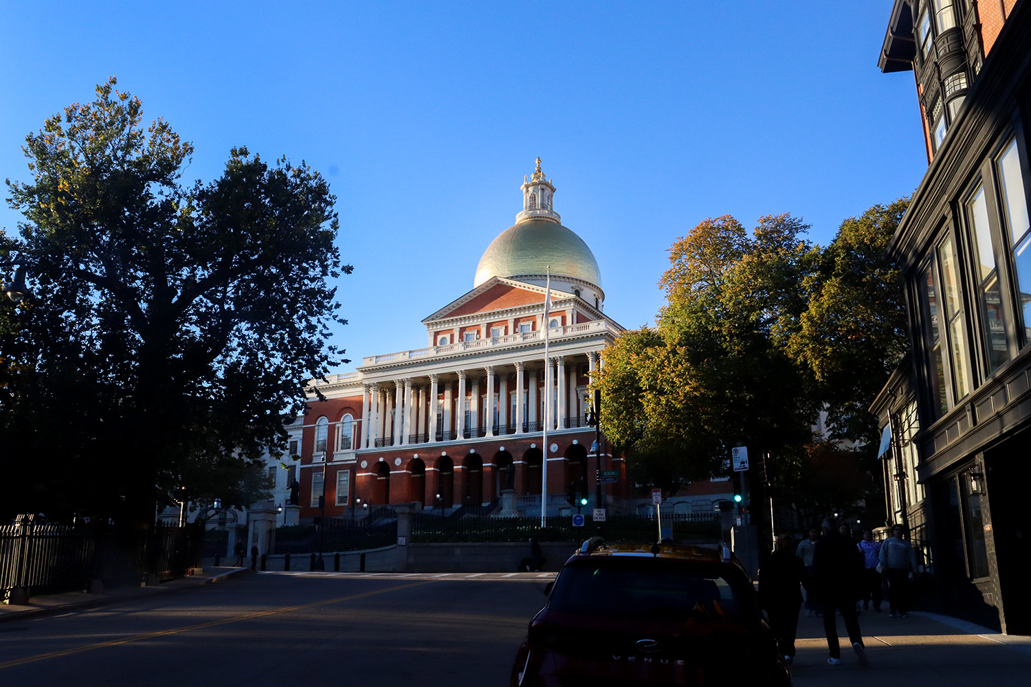
Finally, I reached the namesake of Beacon Street and the destination of our road today. Beacon Hill is Boston’s historic centerpoint, and still remains home to Massachusetts’ state government and capitol building (which after Providence, means we’ve seen 2/6 in New England so far!).
Perhaps even more notably though, Beacon Hill is home to the sprawling Boston Common and Public Garden. Like its neighbors, Boston has a ton of green spaces, including Dorchester’s Franklin Park and the sprawling Emerald Necklace. But the Common is by far its crowning park. From the several historic bronze statues to the huge weeping willow trees over Garden Pond, this is perhaps the single most meticulously curated public green space in New England. Oh yeah, it’s also the oldest public park in America, dating all the way back to 1634!
After summiting Beacon Hill, Beacon Street takes a small curve southeast and ends abruptly at the intersection with Tremont Street, right at the western edge of Downtown. I’m very happy with my timing on this adventure, as I got here just as the sun began to set, lighting up the tall building facades with a bit of autumnal contrast. What a way to finish off the journey!


In our next post, we’ll turn back to our fall foliage focus and head away from the city to the rural woods of Central Maine.
Written and Photographed by Rin Gately. Edited by Keith Libby.
Leave a Reply